


The CopernicusLAC Panama Centre, on behalf of the European Space Agency (ESA) and in close collaboration with the Delegation of the European Union to Panama and the National Authority for Government Innovation (AIG), has launched today a regional training on Remote Sensing applied to land use, land cover and floods. The course takes place from 30 June to 4 July 2025 at the Institute of Technology and Innovation (ITI) located in the City of Knowledge (Clayton, Panama).
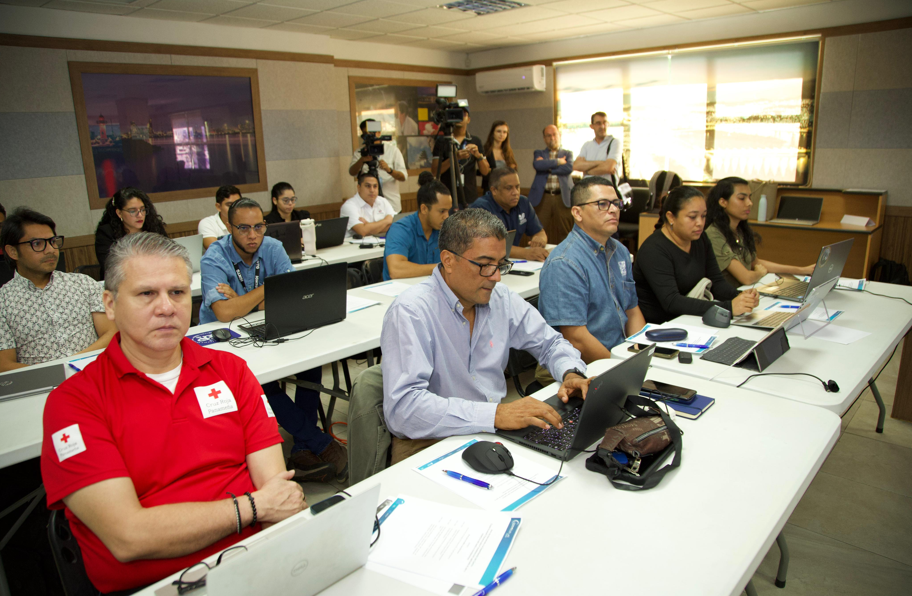
25 participants from Panamanian entities and representatives from countries such as Chile, Peru, Costa Rica and Ecuador will be trained for 5 days in intermediate and advanced Earth Observation (EO) tools designed to decipher and manage land use and land cover dynamics, as well as to mitigate the impact of floods and effectively manage disasters. With a multidisciplinary approach, attendees will gain valuable knowledge on the latest advances in satellite monitoring and early warning systems.
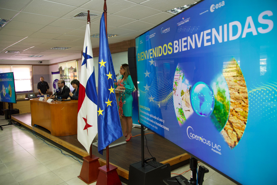
The welcome ceremony was attended by the Ambassador of the European Union to Panama, H.E. Izabela Matusz, who stressed that “the Copernicus programme is one of the pillars of the EU-LAC Digital Alliance and a crucial component of our cooperation with the region, providing Earth Observation data and services to support decision-making and policy formulation in various fields, including disaster risk reduction”.
Dr. Claudia Herrera, Stakeholder Liaison Officer of the CopernicusLAC Panama Centre, said at the inaugural ceremony: “This training represents a space for technical and human encounter which seeks not only to improve capacities, but also to build a shared vision on how space technology can transform our societies. We are called together by a common mission: to use Earth Observation data to improve territorial planning, reduce risks, better prepare for disasters and contribute to the sustainability of our communities.”
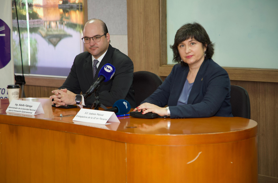
From the National Authority for Government Innovation (AIG), its Administrator, Engineer Adolfo Fábrega, stressed that “as Panama is the host country, we are taking a great responsibility. Not only must we ensure that the Centre operates with excellence, but we must also build from here an innovation ecosystem that generates added value to the data. Panamanian and regional startups, universities, research centres and local governments will be able to develop products, services and solutions which respond to the real challenges of our region.”
The practical approach of the course will allow participants to gain hands-on experience in satellite data processing and analysis. These activities will include accessing and downloading data, preparing and interpreting satellite images and finally applying techniques for impact assessment.
The course is taught by Dr. Carmelo Alonso and Dr. Alfredo Romo, technical experts in Earth Observation from the Spanish company Indra.
About the CopernicusLAC Panama Centre
The activities of the Centre fall within the overall context of the EU-LAC Digital Alliance, which is a strategic framework to promote cooperation between the European Union (EU) and the Latin America and Caribbean (LAC) region on digital and space issues under the umbrella of the EU Global Gateway strategy. In this context, the European Space Agency (ESA) coordinates the implementation of the Centre on the basis of a Contribution Agreement with the Directorate General for International Partnerships (DG INTPA) of the European Commission, and in close collaboration with the Government of Panama, the MIRE (Ministry of Foreign Affairs) and the SENACYT (National Secretariat for Science, Technology and Innovation).
The CopernicusLAC Panama Centre will serve as a platform for innovation in the Latin America and Caribbean region, supporting national and local entities in leveraging Copernicus data and information to enhance socio-economic benefits and resilience. The Centre provides opportunities for engagement and is developing tailor-made EO Services (addressing hydrometeorological hazards, geological hazards and risk exposure services), which are developed in close collaboration with local users and stakeholders, to whom they will be delivered to ensure that the unique needs of the region are addressed in the long term.
In addition, knowledge and skills transfer is a key element of the CopernicusLAC Panama Centre, which hosts a Digital Campus with access to training modules and educational resources for technical users and citizens alike. The Centre will also organise community-building events, policy dialogues and industry matchmaking, as well as hackathons and other Earth observation (EO) data challenges to stimulate user adoption of Copernicus data and innovation. These events will also foster cross-collaboration of EO, Disaster Risk Reduction (DRR) and other relevant ecosystems.
Finally, the Centre will include the development of high-powered infrastructure and cloud computing for the LAC region. One of the ultimate objectives of the Centre is also to promote the development of communities of practice and strengthen capacities in the public sector, academia, the private sector and within social organisations in the knowledge and use of tools for DRR and other areas.