


Date: 26 February 2025
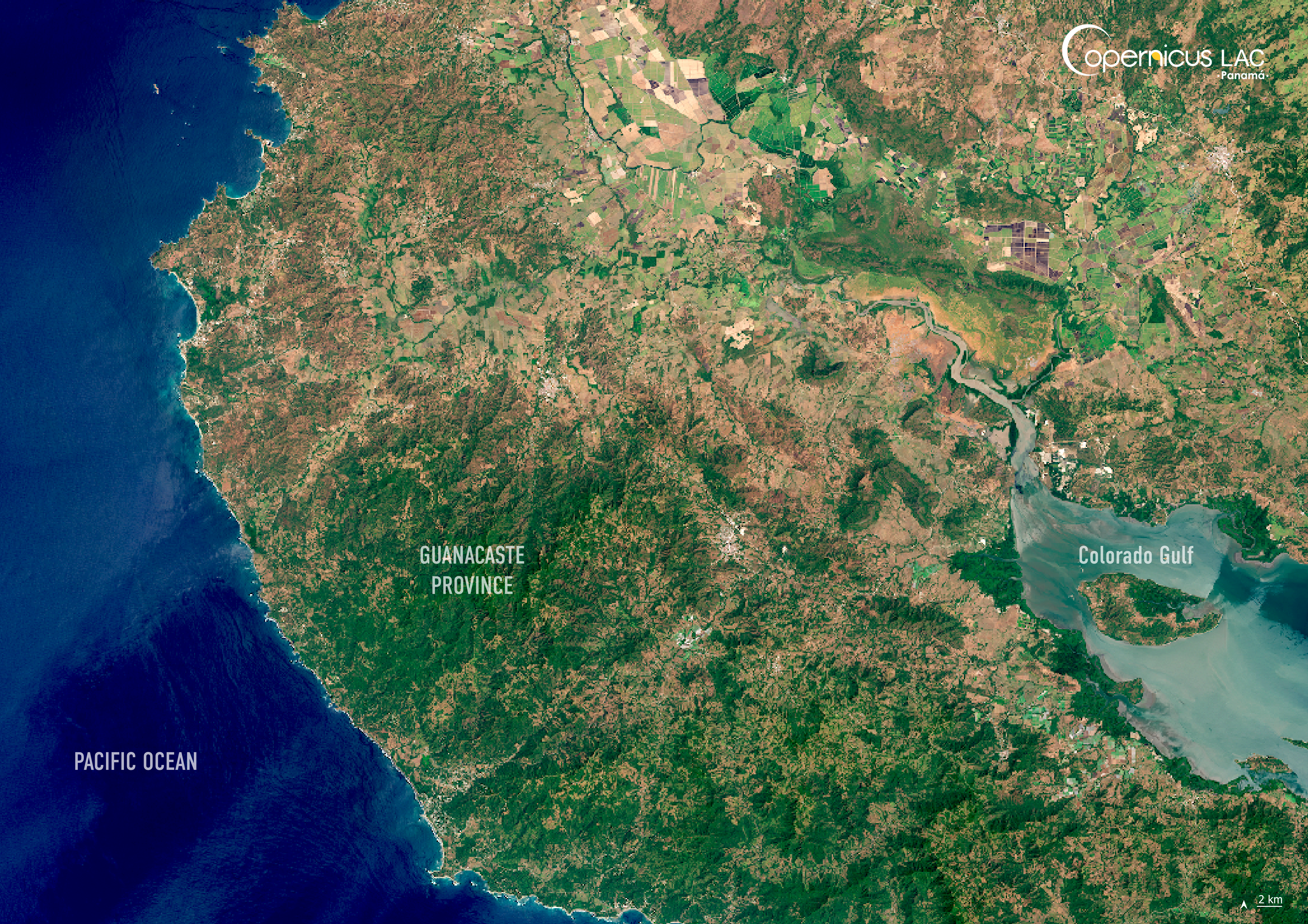
Location: Guanacaste province, Costa Rica
Credit: Copernicus Sentinel-2 image, processed by the CopernicusLAC Panama Centre
Description:
This Copernicus Sentinel-2 image, acquired on 26 February 2025, shows Guanacaste province, Costa Rica.
Home to tropical rainforests, cloud‑covered mountains, and rich ecosystems, Costa Rica is one of the most biodiverse countries in the world. Its unique landscape is the product of dynamic geologic activity. Situated along the boundary between the Cocos and Caribbean tectonic plates, the country is part of a seismically active region which includes approximately 200 volcanic formations. However, the very processes which have shaped these unique features also come with risks: Costa Rica is highly prone to earthquakes, landslides, and flooding.
Recently, tropical storms such as Rafael and Sara in November 2024 triggered flooding and landslides in Guanacaste province, in northwestern Costa Rica. Disaster events like these ones highlight the increasing need for accurate, timely information to plan, respond, and recover, especially as extreme weather patterns intensify.
In this context, the CopernicusLAC Panama Centre acts as a regional hub for Latin America and the Caribbean, supporting countries including Costa Rica in leveraging free and open Copernicus Earth Observation data to improve their disaster preparedness. The Centre is co-developing a range of EO services with local stakeholders, including products such as flood extent mapping and landslide susceptibility mapping. The Centre also enables local communities to improve their skills in leveraging Copernicus data for disaster risk reduction with resources and training materials freely available on the Centre’s Digital Campus.
To stay updated on the latest activities from our Centre, be sure to follow us on LinkedIn, Instagram, X, and subscribe to our newsletter.
Background Information
The Copernicus LAC Panama Centre’s activities take place within the overall context of the EU-LAC Digital Alliance, which is a strategic framework for promoting cooperation between the EU and the LAC region on digital and space issues under the EU Global Gateway umbrella. Within this context, the European Space Agency (ESA) is coordinating the Centre’s implementation on the basis of a Contribution Agreement with the Directorate-General for International Partnerships (DG INTPA) of the European Commission, and in close collaboration with Panama’s government, MIRE (Ministry of Foreign Affairs), Government Innovation Authority (AIG), and SENACYT (National Secretariat for Science, Technology and Innovation).
The CopernicusLAC Panama Centre will serve as a hub for innovation in the Latin America and Caribbean region, supporting national and local entities in leveraging Copernicus data and information to boost socio-economic benefits and resilience. In addition to providing engagement opportunities, the Centre is developing geospatial Disaster Risk Reduction (DRR) Earth Observation (EO) Services (addressing hydrometeorological hazards, wildfires, geological hazards, and hazard exposure) in close collaboration with local users and stakeholders, to whom they will be handed over to ensure that the unique needs of the region are addressed in the long term.
In addition, knowledge and skills transfer is a key element of the CopernicusLAC Panama Centre, which hosts a Digital Campus with access to training modules and educational resources for technical users and citizens alike. The Centre will also organise community-building events, policy dialogues and industry matchmaking, as well as hackathons and other EO data challenges to stimulate user adoption of Copernicus data and innovation. These events will also foster cross-collaboration among EO, disaster risk reduction (DRR) and other relevant ecosystems.
Finally, the Centre will support the development of a high-power computing and data storage cloud infrastructure for the LAC region. One of the final objectives of the Centre is to promote the development of communities of practice and to strengthen the knowledge and use of tools for DRR and other application areas in the public sector, academia, the private sector, and social organisations.