


Date: 12 April 2025
Location: Managua, Nicaragua
Credit: Copernicus Sentinel-2 image, processed by the CopernicusLAC Panama Centre
Description:
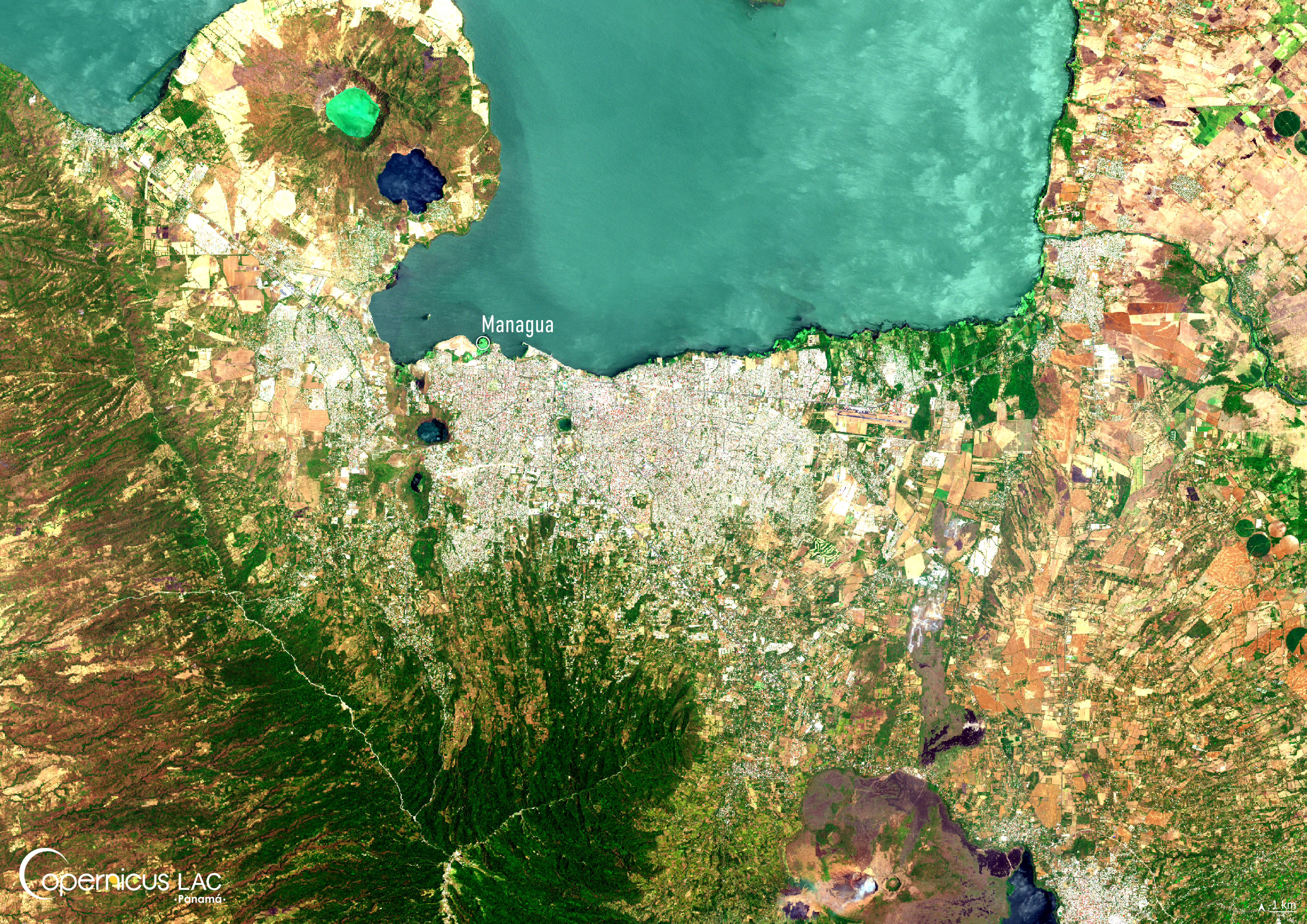
This Copernicus Sentinel-2 image, acquired on 12 April 2025, shows Managua, the capital of Nicaragua.
Nicaragua is situated within a zone of high seismic hazard. This is because the country lies at the boundary of two tectonic plates; the Cocos Plate and the Caribbean Plate, whose activity has not only shaped Nicaragua’s chain of volcanos – including active ones such as Momotombo, Concepción, Telica, and San Cristóbal – but also generated frequent and sometimes destructive earthquakes.
With around 15% of the country’s population concentrated in the capital, the region remains particularly exposed, making seismic and volcano eruption preparedness a critical priority.
To support authorities and researchers in the LAC region in monitoring seismic activity, including the one related to volcanic eruptions, the CopernicusLAC Panama Centre is developing tailored Earth Observation services. These will support users in leveraging free and open Copernicus data to prepare and respond to these events, helping to keep affected communities safer.
To stay updated on the latest activities from our Centre, be sure to follow us on LinkedIn, Instagram and X.
Background Information
The Copernicus LAC Panama Centre’s activities take place within the overall context of the EU-LAC Digital Alliance, which is a strategic framework for promoting cooperation between the EU and the LAC region on digital and space issues under the EU Global Gateway umbrella. Within this context, the European Space Agency (ESA) is coordinating the Centre’s implementation on the basis of a Contribution Agreement with the Directorate-General for International Partnerships (DG INTPA) of the European Commission, and in close collaboration with Panama’s government, MIRE (Ministry of Foreign Affairs), Government Innovation Authority (AIG), and SENACYT (National Secretariat for Science, Technology and Innovation).
The CopernicusLAC Panama Centre will serve as a hub for innovation in the Latin America and Caribbean region, supporting national and local entities in leveraging Copernicus data and information to boost socio-economic benefits and resilience. In addition to providing engagement opportunities, the Centre is developing geospatial Disaster Risk Reduction (DRR) Earth Observation (EO) Services (addressing hydrometeorological hazards, wildfires, geological hazards, and hazard exposure) in close collaboration with local users and stakeholders, to whom they will be handed over to ensure that the unique needs of the region are addressed in the long term.
In addition, knowledge and skills transfer is a key element of the CopernicusLAC Panama Centre, which hosts a Digital Campus with access to training modules and educational resources for technical users and citizens alike. The Centre will also organise community-building events, policy dialogues and industry matchmaking, as well as hackathons and other EO data challenges to stimulate user adoption of Copernicus data and innovation. These events will also foster cross-collaboration among EO, disaster risk reduction (DRR) and other relevant ecosystems.
Finally, the Centre will support the development of a high-power computing and data storage cloud infrastructure for the LAC region. One of the final objectives of the Centre is to promote the development of communities of practice and to strengthen the knowledge and use of tools for DRR and other application areas in the public sector, academia, the private sector, and social organisations.