


Date: 20 March 2025
Location: Santo Domingo, Dominican Republic
Credit: Copernicus Sentinel-2 image, processed by the CopernicusLAC Panama Centre
Description:
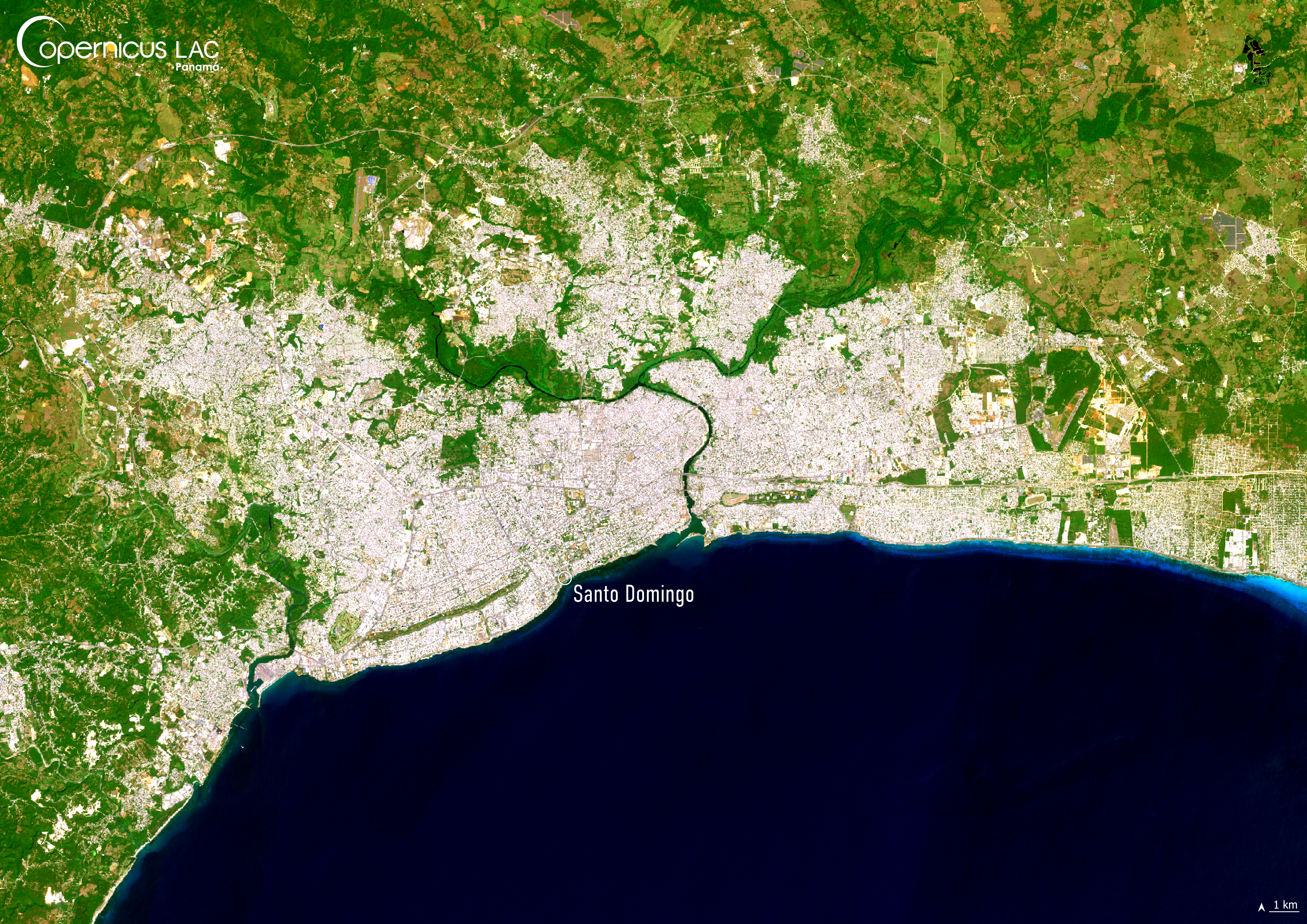
This Copernicus Sentinel-2 image shows Santo Domingo, the capital of Dominican Republic, as it was visible on 20 March 2025.
The country lies within the Atlantic hurricane belt, a region characterised by warm ocean waters and favourable atmospheric conditions which fuel the formation of tropical cyclones, including hurricanes. This makes the country highly vulnerable to their impacts, particularly during the Atlantic hurricane season, which runs from June to November. These storms often bring torrential rain and flooding, affecting not only coastal cities such as Santo Domingo, but also inland cities such as Santiago.
To support national authorities and emergency responders in the LAC region to monitor the consequences of these disasters and their effects on population, the CopernicusLAC Panama Centre is co-developing tailored Earth Observation services, designed to provide data-driven insights to support preparation and recovery efforts after extreme weather events.
To stay updated on the latest activities from our Centre, be sure to follow us on LinkedIn, Instagram and X.
Background Information
The Copernicus LAC Panama Centre’s activities take place within the overall context of the EU-LAC Digital Alliance, which is a strategic framework for promoting cooperation between the EU and the LAC region on digital and space issues under the EU Global Gateway umbrella. Within this context, the European Space Agency (ESA) is coordinating the Centre’s implementation on the basis of a Contribution Agreement with the Directorate-General for International Partnerships (DG INTPA) of the European Commission, and in close collaboration with Panama’s government, MIRE (Ministry of Foreign Affairs), Government Innovation Authority (AIG), and SENACYT (National Secretariat for Science, Technology and Innovation).
The CopernicusLAC Panama Centre will serve as a hub for innovation in the Latin America and Caribbean region, supporting national and local entities in leveraging Copernicus data and information to boost socio-economic benefits and resilience. In addition to providing engagement opportunities, the Centre is developing geospatial Disaster Risk Reduction (DRR) Earth Observation (EO) Services (addressing hydrometeorological hazards, wildfires, geological hazards, and hazard exposure) in close collaboration with local users and stakeholders, to whom they will be handed over to ensure that the unique needs of the region are addressed in the long term.
In addition, knowledge and skills transfer is a key element of the CopernicusLAC Panama Centre, which hosts a Digital Campus with access to training modules and educational resources for technical users and citizens alike. The Centre will also organise community-building events, policy dialogues and industry matchmaking, as well as hackathons and other EO data challenges to stimulate user adoption of Copernicus data and innovation. These events will also foster cross-collaboration among EO, disaster risk reduction (DRR) and other relevant ecosystems.
Finally, the Centre will support the development of a high-power computing and data storage cloud infrastructure for the LAC region. One of the final objectives of the Centre is to promote the development of communities of practice and to strengthen the knowledge and use of tools for DRR and other application areas in the public sector, academia, the private sector, and social organisations.