


Date: 04 November 2024
Location: Paramaribo, Suriname
Credit: Copernicus Sentinel-2 image, processed by the CopernicusLAC Panama Centre
Description:
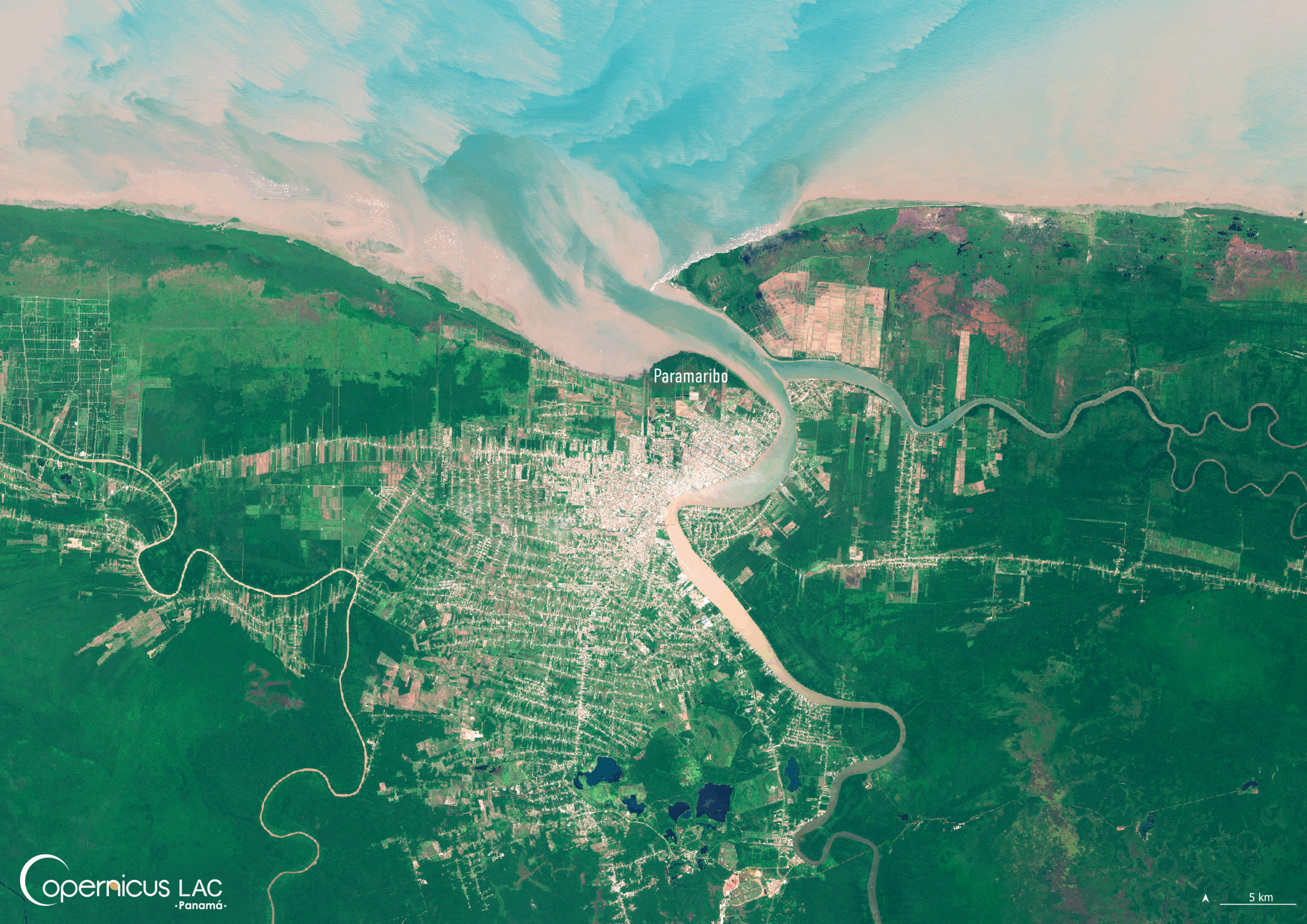
This Copernicus Sentinel-2 image, acquired on 04 November 2024, shows Paramaribo, the capital of Suriname.
Suriname is highly vulnerable to climate-related hazards, including flooding, hurricanes, storms and droughts. Approximately 30% of the country territory lies within a few meters above sea level, and about 87% of its population resides in the coastal areas, making them particularly susceptible to coastal and rainfall-related floods. The 2022 floods, driven by the La Niña phenomenon, and the severe drought beginning in early 2023 have highlighted the country’s vulnerability to extreme weather events.
In this context, the CopernicusLAC Panama Centre is co-developing tailored Earth Observation services within the Hydrometeorological Hazards and Exposure themes to address these risks leveraging the free and open data provided by the Copernicus Sentinel satellites. These include services related to flood frequency mapping, drought and crop surveillance and urban characterisation for exposure mapping. These services will support stakeholders across the LAC region, including in Suriname, in responding to and preparing for future events.
To stay updated on the latest activities from our Centre, be sure to follow us on LinkedIn, Instagram, X, and subscribe to our newsletter.
Background Information
The Copernicus LAC Panama Centre’s activities take place within the overall context of the EU-LAC Digital Alliance, which is a strategic framework for promoting cooperation between the EU and the LAC region on digital and space issues under the EU Global Gateway umbrella. Within this context, the European Space Agency (ESA) is coordinating the Centre’s implementation on the basis of a Contribution Agreement with the Directorate-General for International Partnerships (DG INTPA) of the European Commission, and in close collaboration with Panama’s government, MIRE (Ministry of Foreign Affairs), Government Innovation Authority (AIG), and SENACYT (National Secretariat for Science, Technology and Innovation).
The CopernicusLAC Panama Centre will serve as a hub for innovation in the Latin America and Caribbean region, supporting national and local entities in leveraging Copernicus data and information to boost socio-economic benefits and resilience. In addition to providing engagement opportunities, the Centre is developing geospatial Disaster Risk Reduction (DRR) Pilot Services (addressing hydrometeorological hazards, geological hazards, and hazard exposure) in close collaboration with local users and stakeholders, to whom they will be handed over to ensure that the unique needs of the region are addressed in the long term.
In addition, knowledge and skills transfer is a key element of the CopernicusLAC Panama Centre, which hosts a Digital Campus with access to training modules and educational resources for technical users and citizens alike. The Centre will also organise community-building events, policy dialogues and industry matchmaking, as well as hackathons and other Earth Observation (EO) data challenges to stimulate user adoption of Copernicus data and innovation. These events will also foster cross-collaboration among EO, disaster risk reduction (DRR) and other relevant ecosystems.
Finally, the Centre will support the development of a high-power computing and data storage cloud infrastructure for the LAC region. One of the final objectives of the Centre is to promote the development of communities of practice and to strengthen the knowledge and use of tools for DRR and other application areas in the public sector, academia, the private sector, and social organisations.