- The training will take place over 5 days.
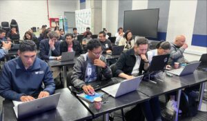
- 30 participants from 8 different countries met in Bogota to strengthen their capacities and contribute to increased resilience of the Latin American and Caribbean region to disasters.
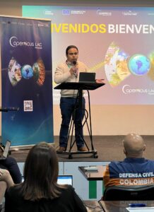
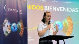
Bogota, 24 March 2025. Today, the CopernicusLAC Centre in Panama, on behalf of the European Space Agency (ESA), launched a regional training on Remote Sensing for Hydrometeorological Hazards. The course will take place from 24 to 28 March 2025 at the headquarters of the Institute of Hydrology, Meteorology and Environmental Studies (IDEAM) in Bogota, which, together with the National Unit for Disaster Risk Management (UNGRD, have joined the CopernicusLAC Centre in organising this training. The course is additonally supported by the Delegation of the European Union to Colombia and promoted by the Copernicus Community of Colombia.
30 participants from Colombian entities as well as participants from countries including Ecuador, Costa Rica, Mexico, Guatemala, Peru, the Dominican Republic, and Panama will be trained for five days in intermediate to advanced Earth Observation (EO) tools related to the risks of hydrometeorological hazards, such as floods. The course is designed to train participants in the use of satellite data, specifically those provided by Copernicus, to support flood risk assessment and management. Participants will explore how optical and synthetic aperture radar (SAR) imagery can be used to identify areas susceptible to flooding, map affected areas in near real time during an event, and carry out impact analysis.
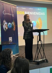
Ms. Claudia Herrera, Stakeholder Liaison Officer of the CopernicusLAC Panama Centre, said at the welcoming ceremony: ‘The Centre is committed to strengthening capacities for disaster risk reduction so that the valuable tools provided by Copernicus can be fully exploited. This workshop is highly relevant for identifying exposure and vulnerability; through coordinated efforts with entities in the region we are generating knowledge and skills in the different institutions that make up the national risk management systems in Latin America, aware that year after year they face complex challenges in the face of increasingly intense, recurrent and uncertain events. The use of EO data allows us to be more efficient in preparedness, response and recovery actions to build more disaster resilient territories based on technical and scientific data that complement national and local actions’.
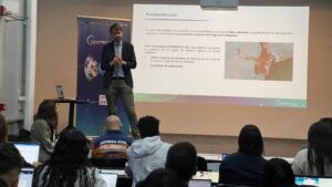
The practical approach of the course will allow participants to gain hands-on experience in satellite data processing and analysis. These practical activities will include accessing and downloading data, preparing and interpreting satellite images, and applying techniques for impact assessment.
The Deputy Director of Hydrology at IDEAM, Mr. Fabio Bernal, said that ‘this type of training and tools will improve the response and monitoring by improving the installed capacity in the different participating institutions in the country and the region, and which have challenges in terms of potential research topics’.
Ms. Ana Milena Prada Uribe, Deputy Director for Risk Knowledge at the UNGRD, stressed that ‘effective risk management requires innovative tools that allow us to anticipate risk scenarios, assess their potential impact and respond efficiently and effectively. Earth Observation and the data provided by Copernicus represent a significant advance in our work, as they facilitate the early detection of vulnerable areas, the monitoring of events in near real time and the generation of key information for decision making’.
The course will be led by Dr. Alessandro Masoero, Associate Director of Programmes at CIMA Research Foundation (Italy), Dr. Francesca Trevisiol, Researcher in Earth Observation at the same institution, and Dr. Caterina Peris Ferrús, Technical Manager of the development of the CopernicusLAC services. The three experts will provide valuable training to the attendees.
Copernicus delivers information services based on satellite observation data and in situ data from ground-based, airborne and maritime measurement systems. These services enable service providers, public administrations and international organisations to make informed decisions and improve the quality of life. In addition, the information services provided are freely and openly accessible to all users.
The inauguration ceremony also included the words of the Ambassador of the European Union in Colombia, Gilles Bertrand, who highlighted in a video recorded especially for this occasion that ‘in a particularly vulnerable region such as Latin America and the Caribbean, the development of regional capacities for the processing of Copernicus data can support strategic decision making for the benefit of the most exposed and vulnerable populations in the region’.
About the CopernicusLAC Panama Centre
The activities of the Centre fall within the overall context of the EU-LAC Digital Alliance, which is a strategic framework to promote cooperation between the European Union (EU) and the Latin America and Caribbean (LAC) region on digital and space issues under the umbrella of the EU Global Gateway strategy. In this context, the European Space Agency (ESA) coordinates the implementation of the Centre on the basis of a Contribution Agreement with the Directorate General for International Partnerships (DG INTPA) of the European Commission, and in close collaboration with the Government of Panama, the MIRE (Ministry of Foreign Affairs) and the SENACYT (National Secretariat for Science, Technology and Innovation).
The CopernicusLAC Panama Centre will serve as a platform for innovation in the Latin America and Caribbean region, supporting national and local entities in leveraging Copernicus data and information to enhance socio-economic benefits and resilience. The Centre provides opportunities for engagement and is developing tailor-made geospatial Pilot Services (addressing hydrometeorological hazards, geological hazards and risk exposure services), which are developed in close collaboration with local users and stakeholders, to whom they will be delivered to ensure that the unique needs of the region are addressed in the long term.
In addition, knowledge and skills transfer is a key element of the CopernicusLAC Panama Centre, which hosts a Digital Campus with access to training modules and educational resources for technical users and citizens alike. The Centre will also organise community-building events, policy dialogues and industry matchmaking, as well as hackathons and other Earth observation (EO) data challenges to stimulate user adoption of Copernicus data and innovation. These events will also foster cross-collaboration of EO, Disaster Risk Reduction (DRR) and other relevant ecosystems.
Finally, the Centre will include the development of high-powered infrastructure and cloud computing for the LAC region. One of the ultimate objectives of the Centre is also to promote the development of communities of practice and strengthen capacities in the public sector, academia, the private sector and within social organisations in the knowledge and use of tools for DRR and other areas.