


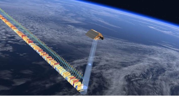
Sentinel missions as part of Copernicus
Copernicus is the Earth Observation (EO) component of the European Union’s Space Programme. At its heart are the Sentinel missions, which provide free and open data to monitor the Earth’s surface, oceans, and atmosphere. Since the launch of Sentinel-1A in 2014, the Sentinel fleet has steadily grown, becoming a global resource for climate, atmosphere, marine, and land monitoring, as well as disaster management and risk reduction.
For the Latin America and Caribbean (LAC) region, this continuity is key. The region is highly exposed to multiple hazards such as floods, forest fires, droughts, hurricanes, and the pressure of rapid urbanisation which increases vulnerability. In this context, reliable, long-term EO data is key to improve disaster preparedness, support sustainable resource management, and build resilience against climate change.
To ensure this legacy continues, new Sentinel Satellites have been launched in the past year, and more are scheduled before the end of 2025.
The third generation: Sentinel-2C and Sentinel-1C
2024 marked two major milestones with the launches of Sentinel-1C(5 December 2024) and Sentinel-2C (5 September 2024), each adding a third satellite to their respective missions.
Following its launch, the Sentinel-2C satellite has begun delivering high-resolution optical images thanks to its 13 spectral bands, spanning the visible, near infrared, and shortwave infrared spectrum. With all three Sentinel-2 satellites now operational, image acquisition frequency is significantly improved, ensuring more consistent coverage worldwide.
The optical data from the new Copernicus Sentinel-2C is key to monitoring wildfires, droughts, changes in water bodies, and floods. Since its recent launch, it has already contributed to the monitoring of major events in the LAC region, such as the floods which occurred in June 2025 along the Jacuí River and the city of Porto Alegre, in Brazil.
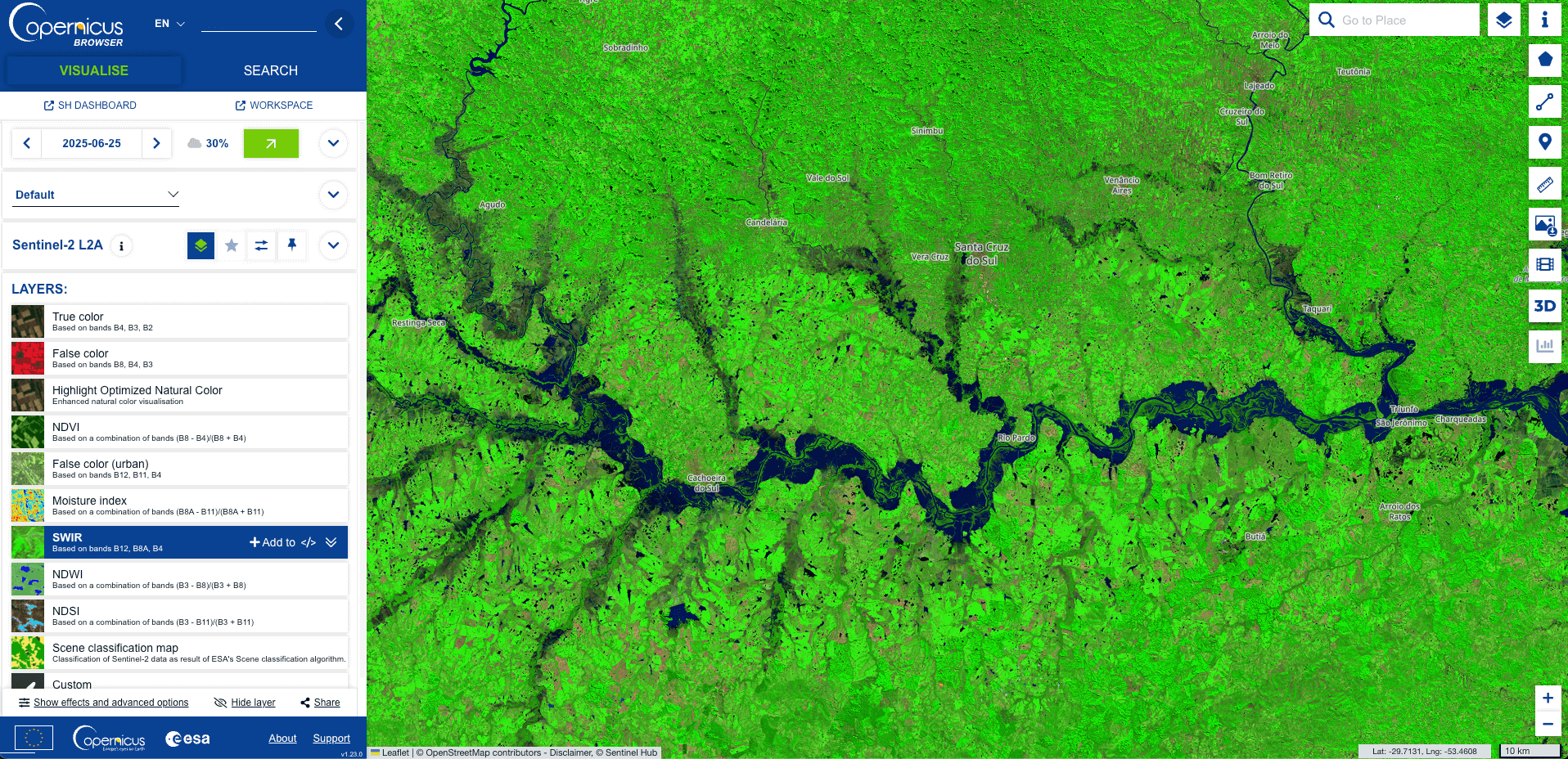
False-colour image of the Jacuí River, Brazil, showing flooded areas in blue. Credit: European Union, Copernicus Sentinel-2C, 25 June 2025.
On 5 December 2024, the new Copernicus Sentinel-1C satellite joined the Copernicus Sentinel-1A satellite already in operation. Equipped with a Synthetic Aperture Radar (SAR) instrument, Sentinel-1C can capture imagery both day and night, regardless of weather conditions. In LAC region, this capability is key during extreme atmospheric events such as hurricanes, when dense cloud systems often cover the areas most affected at the peak of the crisis. Therefore, SAR data allows flooded zones and storm impacts to be mapped in near real time.
The first observations are already delivering valuable insights into hydrological systems across LAC.
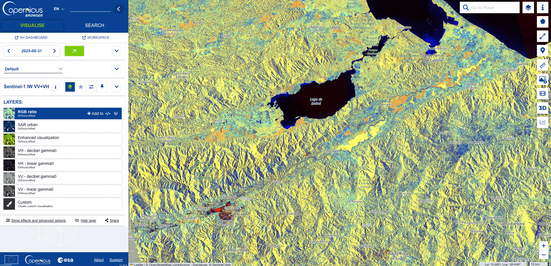
Radar image showing water bodies in blue and agricultural fields in shades of yellow, orange and red in the vicinity of the Motagua River, Guatemala. Credit: European Union, Copernicus Sentinel-1C, 31 August 2025.
Both missions data is accessible via the Copernicus Data Space Ecosystem portal, ensuring that scientists, institutions, and decision-makers across the LAC region can benefit directly.
Atmospheric monitoring with Sentinel-5A
On 13 August 2025, the MetOp-SG-A1 meteorological satellite was launched with the Copernicus Sentinel-5A instrument on board. This instrument is a high-resolution imaging spectrometer which, together with data from Sentinel-4A and the Sentinel-5P satellite (already in orbit), will complement the constellation dedicated to Copernicus atmospheric monitoring.
Sentinel-5A spectrometer, will provide data on the concentration of key atmospheric variables such as methane, nitrogen dioxide, ozone, and other key tropospheric parameters, to support the monitoring of air quality and its impacts on health.
The following image is an artist’s impression of how the Copernicus Sentinel-5A spectrometer would observe aerosol values over South America during a fire crisis.
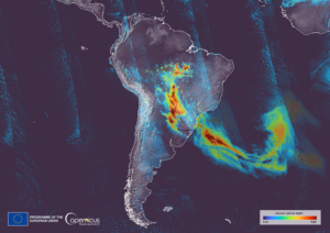
Simulated image created to illustrate how the data from Sentinel-5A would look. Generated using data from Sentinel-5P. Credit: European Union, Copernicus Sentinel-5P imagery.
Future launches of Sentinel-1D and Sentinel-6B
In line with the continuity of Copernicus, new satellites will soon be added to the current operational missions.
For the Sentinel-1 mission, the focus on Synthetic Aperture Radar (SAR) data acquisition remains indispensable. It is the only global SAR dataset which is both open and freely accessible, making it a unique resource for monitoring and research worldwide. Beyond its wide range of applications, Sentinel-1 data has also become a catalyst for economic innovation, fuelling downstream services and enabling new startups to emerge worldwide.
In this context, the launch of the mission’s fourth satellite, Copernicus Sentinel-1D, is already in preparation. Built by Thales Alenia Space, the satellite departed from the company’s facilities in Cannes on 1 September 2025 and arrived in French Guiana on 11 September 2025, where it was transported to the European Spaceport in Kourou for launch preparations. The launch is currently scheduled for 4 November 2025.
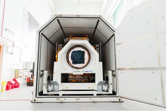
Copernicus Sentinel-1D in its protective casing prior to shipment from Thales Alenia Space’s facility in Cannes. Credit: ESA-P. Sebirot
Turning to the oceans, the Copernicus Sentinel-6 mission continues to deliver unprecedented information on sea surface height. The first satellite, Sentinel-6A, was launched on 21 November 2020, and its successor, Sentinel-6B, will extend its monitoring capacity until at least 2030. The new satellite will provide continuous measurements of sea levels, waves, temperature, and winds, supporting both climate research and early forecasting of extreme events such as hurricanes.
Sentinel-6B is the result of a major international collaboration involving ESA, EUMETSAT, NASA, and NOAA, with financial support from the European Commission and technical contributions from the French Space Agency (CNES). The Sentinel-6B is currently at NASA’s Vandenberg Space Force Base, where preparations are under way for its launch in November 2025.
Artist’s impression of a Copernicus Sentinel-6 satellite. Credit: ESA
The role of the CopernicusLAC Panama Centre
The continuity and expansion of Sentinel missions reaffirm the role of Copernicus in supporting stakeholders to address global environmental challenges, ensuring the long-term monitoring of the Earth, and guaranteeing free and open access to data. For the LAC, this wealth of information is increasingly important to support sustainable development and strengthen strategies for disaster risk reduction.
Within the framework of the EU-LAC Alliance, a strategic initiative promoting cooperation between the European Union (EU) and the LAC region on digital and space issues under the EU Global Gateway strategy, the ESA coordinates the implementation of the CopernicusLAC Panama Centre. Acting as a regional hub, the Centre helps communities, institutions, and individuals in harnessing Copernicus data to better prepare for disasters and confront the impacts of climate change. One of its core activities is the co-development of EO Services tailored to the region’s needs, covering four main areas: hydrometeorological hazards, wildfires, geological hazards, and exposure mapping.
For example, the hydrometeorological services rely on Sentinel-1 SAR data to monitor floods, capturing key information such as their extent, depth, frequency, and related risk. These insights are meant to enable LAC authorities to better plan and respond in the face of emergencies.
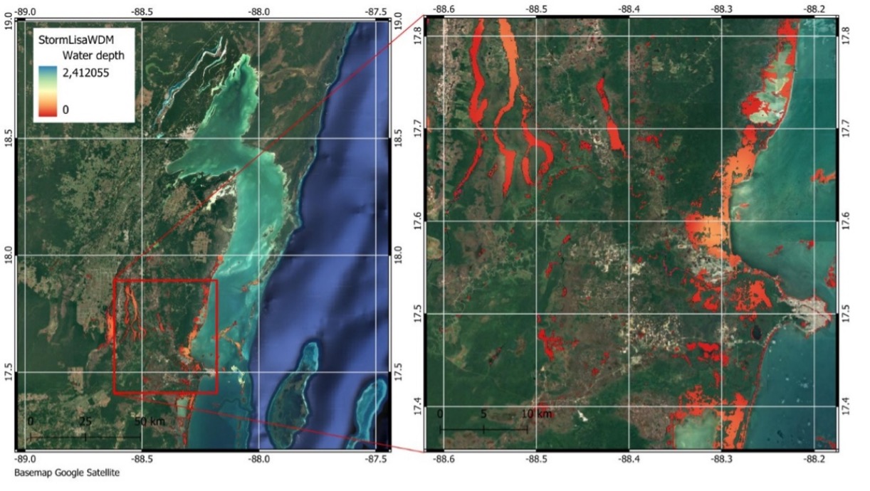
Water depth map derived from Sentinel-1 data showing flooding in Belize on 11 March 2022. Credit: CopernicusLAC Platform
In addition, the Centre supports capacity building in the region through online and onsite training sessions. These courses are designed to equip participants with theorical and practical skill to exploit Copernicus Sentinels data for disaster risk reduction. Past session and resources, freely available in our Digital Campus, have covered topics such as:
- Remote sensing applications for environmental protection
- Remote sensing applied to flood monitoring
- Remote sensing applied to land use/land cover
- Remote sensing in fire preparedness
📝 Register to the digital campus here:
Background Information
The activities of the Centre fall within the overall context of the EU-LAC Digital Alliance, which is a strategic framework to promote cooperation between the European Union (EU) and the LAC region on digital and space issues under the umbrella of the EU Global Gateway strategy. In this context, the European Space Agency (ESA) coordinates the implementation of the Centre on the basis of a Contribution Agreement with the Directorate General for International Partnerships (DG INTPA) of the European Commission, and in close collaboration with the Government of Panama, the MIRE (Ministry of Foreign Affairs) and the SENACYT (National Secretariat for Science, Technology and Innovation).
The CopernicusLAC Panama Centre will serve as a platform for innovation in the Latin America and Caribbean region, supporting national and local entities in leveraging Copernicus data and information to enhance socio-economic benefits and resilience. The Centre provides opportunities for engagement and is developing tailor-made EO Services (addressing hydrometeorological hazards, geological hazards and risk exposure services), which are developed in close collaboration with local users and stakeholders, to whom they will be delivered to ensure that the unique needs of the region are addressed in the long term.
In addition, knowledge and skills transfer is a key element of the CopernicusLAC Panama Centre, which hosts a Digital Campus with access to training modules and educational resources for technical users and citizens alike. The Centre will also organise community-building events, policy dialogues and industry matchmaking, as well as hackathons and other Earth observation (EO) data challenges to stimulate user adoption of Copernicus data and innovation. These events will also foster cross-collaboration of EO, Disaster Risk Reduction (DRR) and other relevant ecosystems.
Finally, the Centre will include the development of high-powered infrastructure and cloud computing for the LAC region. One of the ultimate objectives of the Centre is also to promote the development of communities of practice and strengthen capacities in the public sector, academia, the private sector and within social organisations in the knowledge and use of tools for DRR and other areas.