An average of ten tropical storms develop over the Atlantic Ocean, Caribbean Sea, and Gulf of Mexico each year, with six of these becoming hurricanes. Tropical storms and hurricanes are very dangerous, bringing powerful winds, heavy rainfall, storm surges and flooding, which can lead to widespread destruction and loss of life. The Caribbean is a region especially vulnerable to hurricanes. From 1963 to 2017, countries in the Caribbean were affected by yearly losses equivalent to 17% of their GDP because of storm damages.
The latest in this series is Hurricane Beryl. The uniqueness of Beryl lies in the fact that it is the earliest hurricane of Category 5 recorded in this area since 1851, the first year for which there are records. Prior to Beryl, the only hurricane to reach Category 5 status as early as July was Emily in 2005. Although the hurricane season runs from June to November, the worst months for these natural disasters in the region are historically August and September.
With a warming climate, the impact of hurricanes in the Caribbean will become more severe as a consequence of warmer ocean temperatures, which can increase the frequency and intensity of tropical storms. In this context, Earth Observation (EO) data from Copernicus can help prepare for and monitor the consequences of tropical storms and hurricanes by providing useful geospatial information.
This article explores how Copernicus has supported local authorities in responding to Hurricane Beryl and how future opportunities provided by the CopernicusLAC Panama Centre will support communities in the Latin America and Caribbean (LAC) region to increase resilience to hurricanes and other climate change-induced weather events.

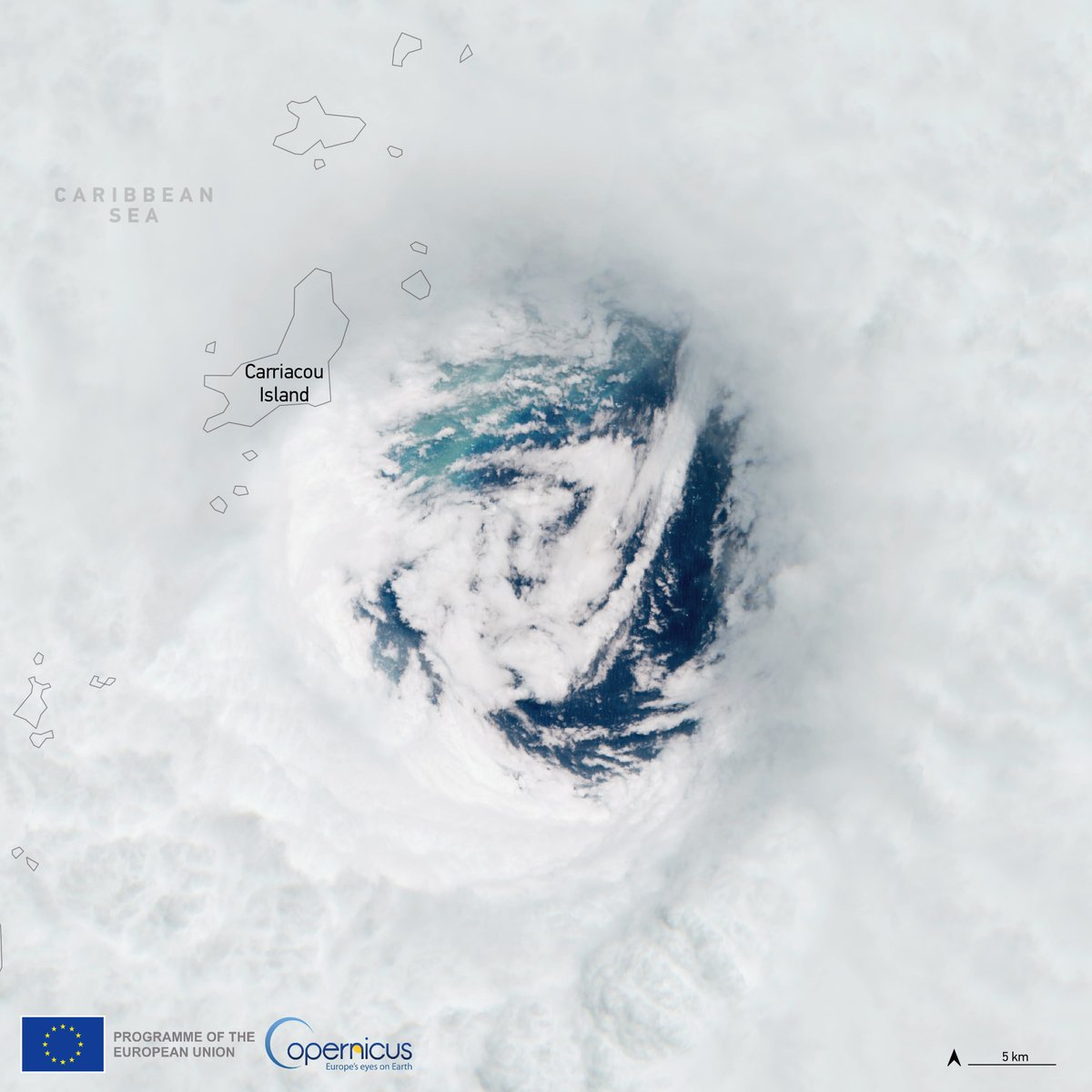
Copernicus Sentinel-2 image acquired on 1 July 2024 showing the eye of Hurricane Beryl as it passes through the Caribbean Sea. Credit: European Union, Copernicus Sentinel-2, 2024.
The role of Copernicus Services data
Copernicus satellite data and the value-added information delivered by the Copernicus Services is available before, during, and after hurricanes to obtain insights such as forecasts about sea surface wave height as well as assessments of the extent and level of damage caused by their passage. It can also inform preparedness activities with risk, hazard, and vulnerability information.
For example, the Copernicus Marine Service (CMEMS) provides support to decision makers and local communities before and during a hurricane. The passage of a hurricane over a sea such as the Caribbean can have major consequences on navigation because of the presence of high waves and extreme winds. CMEMS data can be leveraged by local authorities to restrict navigation, forecast where waves will have the greatest impact, and plan for safer navigation routes. This CMEMS visual shows that Beryl, after passing the Lesser Antilles islands, was forecasted to cause waves more than 5 metres high.
The path of hurricane Beryl through the Caribbean Sea according to the models of the Copernicus Marine Service. In particular, the GIF shows the Sea Surface Wave Height forecast for the period between 1 and 6 July 2024. Credit: European Union, Copernicus Marine Service, 2024.
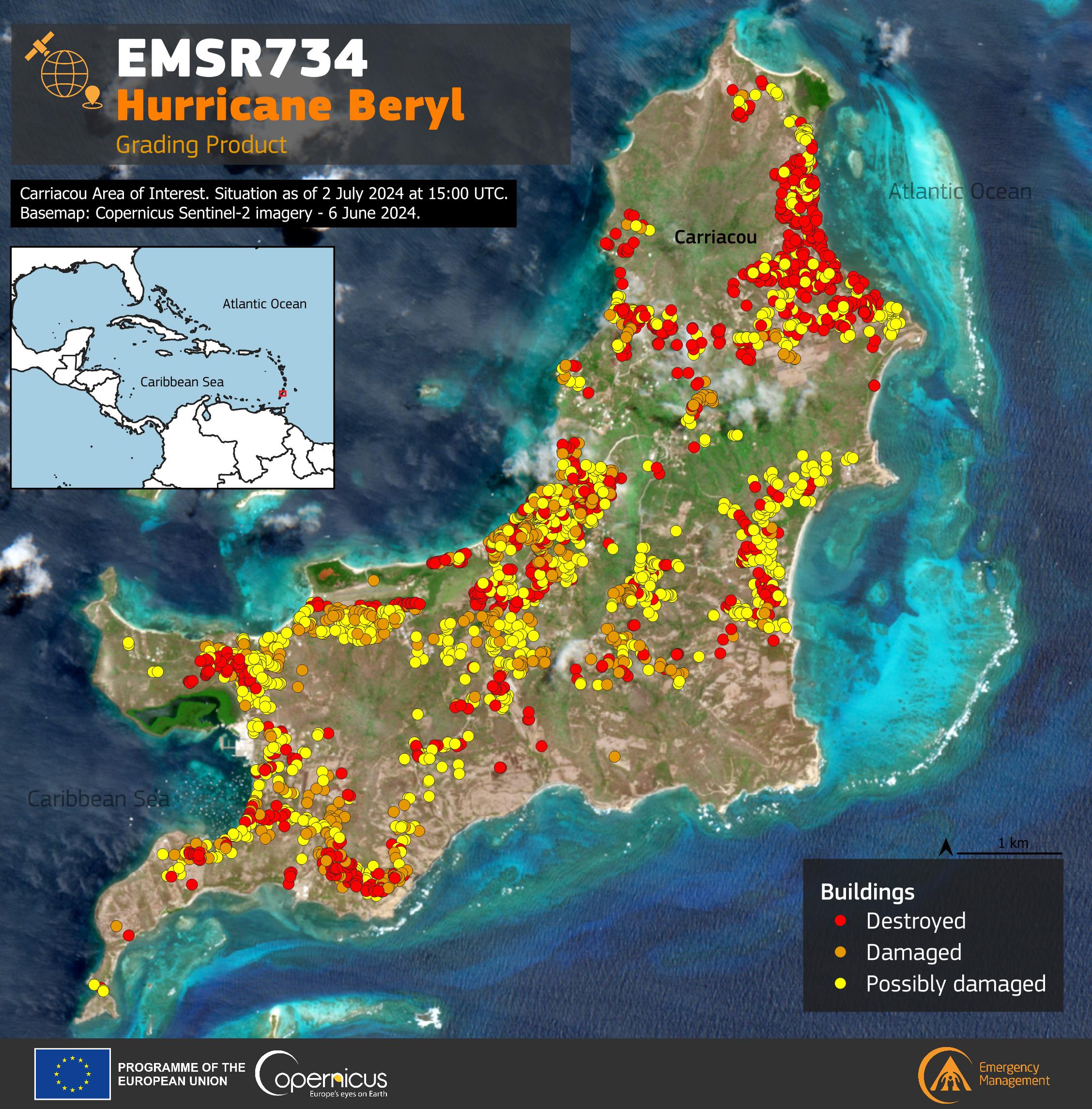
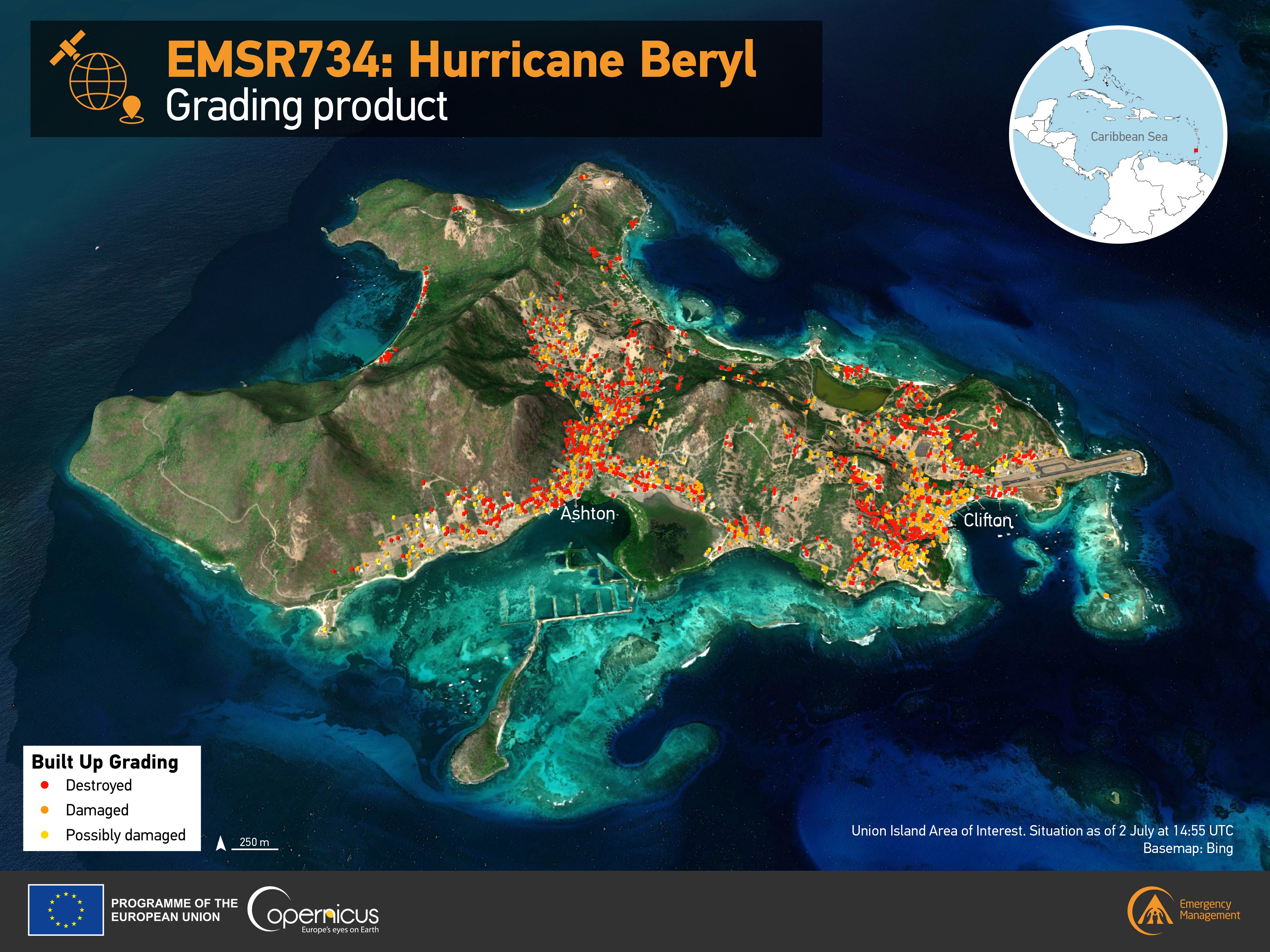
Another relevant example is the timely geospatial information provided by the Copernicus Emergency Management Service (CEMS). On 1 July 2024, the CEMS On-Demand Mapping team was activated by the European External Action Service (EEAS) to deliver assessments of the damage caused by the passage of Hurricane Beryl in several areas of the Caribbean. The visualisations below, based on CEMS data, show the over 2,400 affected buildings detected on the island of Carriacou, Grenada (left) and the damage on Union Island in Saint Vincent and the Grenadines (right), where around 60% of the buildings in the area of interest were destroyed.


Data visualisations showing the damage caused by the passage of hurricane Beryl on the island of Carriacou, Grenada (top) and on Union Island in Saint Vincent and the Grenadines (bottom). Credit: European Union, Copernicus Emergency Management Service (CEMS), 2024.
Looking forward: the role of the CopernicusLAC Panama Centre
Beryl’s intensity was a result of abnormally warm ocean water, a consequence of a warming climate. As climate change continues to increase the occurrence and intensity of tropical storms and hurricanes, Copernicus data will play an important role in understanding long-term trends in hurricane activity and how they are impacted by climate change.
In this context, the CopernicusLAC Panama Centre serves as a hub for communities and individuals interested in leveraging Copernicus open and free data for a wide variety of applications, including or climate change-related applications.
To promote knowledge and skills transfer, the Centre will provide trainings and educational resources on EO data. The Centre will also organise political dialogues, community-building and industrial matchmaking events, as well as hackathons and other EO data challenges to foster user uptake and innovation using Copernicus data and to act as a focal point for community engagement on these topics. The Centre’s activities will also include the development of a high power and cloud computing infrastructure for the LAC region.
Indeed, the use of EO technologies by institutions in the LAC region to address environmental, humanitarian, economic, and societal challenges has been steadily increasing. To complement these existing activities, and to support the further development of local capabilities and capacity building, the CopernicusLAC Panama Centre will develop three streams of EO-based pilot services which will be transferred to local stakeholders for continued implementation after the end of the pilot demonstration phase, namely a hydrometeorological service, a geological hazards service, and an exposure service.
To ensure that the unique needs, requirements, gaps, and priorities of the region underpin the development and direction of the pilot services, their development is based on stakeholder consultations and will be assessed for validity through various use cases. In addition, the pilot services will leverage EO data to complement existing regional systems while helping to boost the benefits for local communities.
The Copernicus LAC Panama Centre’s activities take place within the overall context of the EU-LAC Digital Alliance, which is a strategic framework for promoting cooperation between the EU and the LAC region on digital and space issues under the EU Global Gateway umbrella. Within this context, the European Space Agency (ESA) is coordinating the Centre’s implementation on the basis of a Contribution Agreement with the Directorate-General for International Partnerships (DG INTPA) of the European Commission, and in close collaboration with Panama’s government, MIRE (Ministry of Foreign Affairs), Government Innovation Authority (AIG), and SENACYT (National Secretariat for Science, Technology and Innovation).


