


Date: 12 January 2025
Location: Canouan, Mayreau, Tobago Cays, and Union Island (Saint Vincent and the Grenadines)
Credit: Copernicus Sentinel-2 image, processed by the CopernicusLAC Panama Centre
Description:
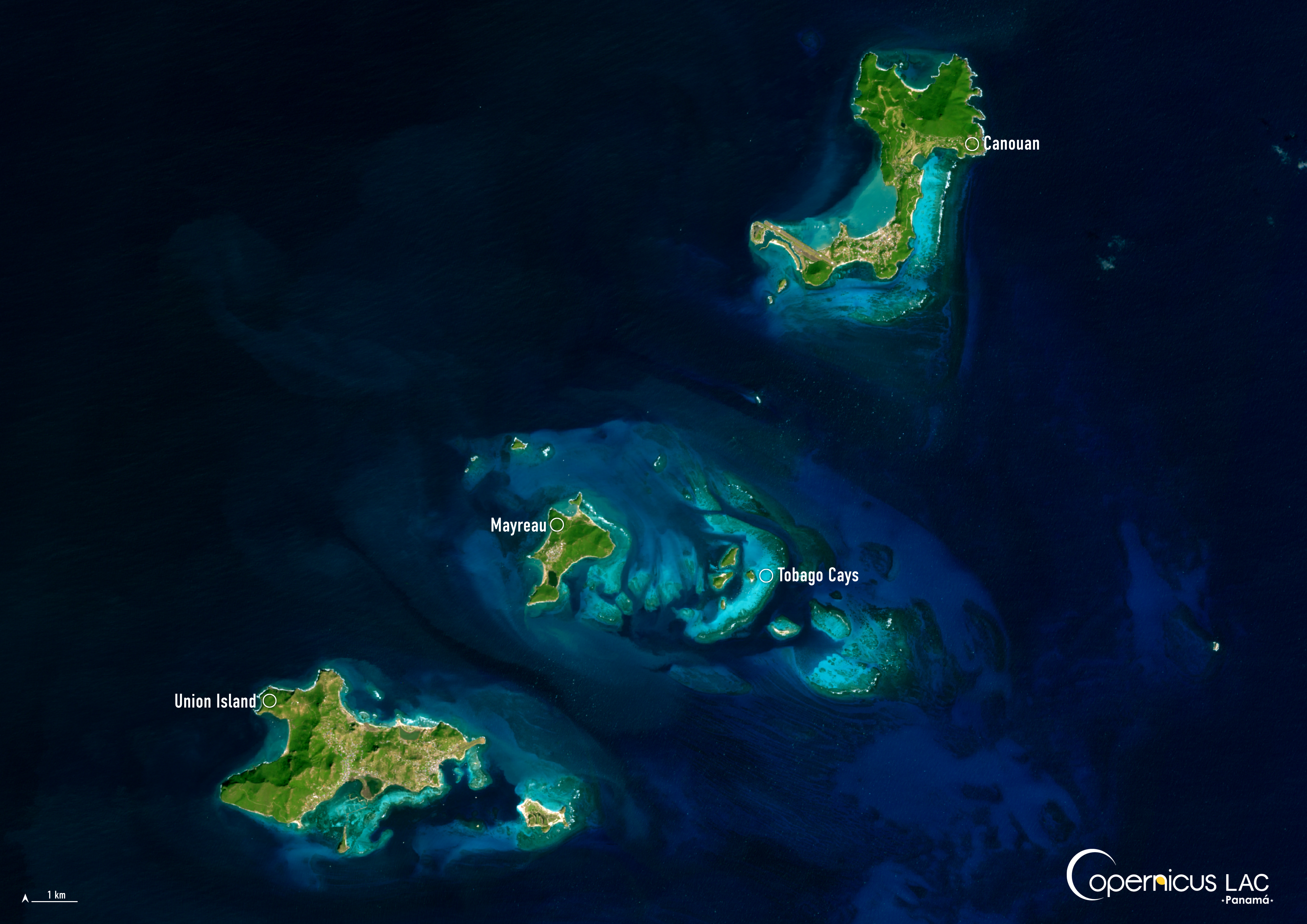
On 1 July 2024, Hurricane Beryl, which broke records for reaching category five intensity earlier in the season than any other Atlantic Ocean hurricane, made landfall in Saint Vincent and the Grenadines. The storm caused widespread destruction across the country, damaging buildings as well as power, telecommunications, and transportation infrastructure. According to the World Bank, the southern Grenadines were the worst hit by Beryl, accounting for 81% of the country’s total damage.
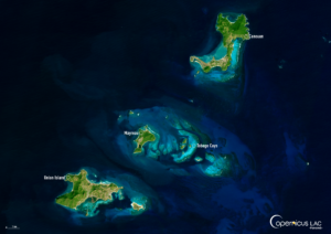
The Grenadine islands of Canouan, Mayreau, Tobago Cays, and Union Island, which were particularly impacted by Beryl, are shown in this image acquired by one of the Copernicus Sentinel-2 satellites on 12 January 2025.
Open data from the Copernicus satellites and services delivers important insights before the formation of hurricanes, as well as during and after their passage. This information informs preparedness activities and supports recovery operations in the Latin American and Caribbean (LAC) region. Read more about the applications of Copernicus data and services for hurricanes in this blog article.
In this context, the CopernicusLAC Panama Centre works to increase uptake of Copernicus data in the LAC region by providing trainings and educational resources on Copernicus data for disaster risk reduction, including for hurricanes. Materials from past training courses are made available to all registered users of the CopernicusLAC Panama Centre Digital Campus.
In parallel, the Centre is developing three streams of Earth Observation-based pilot services to be handed over to local stakeholders for continued implementation after the end of the pilot demonstration phase. One of these streams – the hydrometeorological service – will support preparedness and response measures in the LAC region by helping authorities to identify future risks, assess post-disaster damage, and complement existing early warning systems, ultimately increasing regional resilience to hydrometeorological disasters.
To stay updated on upcoming trainings and latest developments of the pilot services, be sure to follow our Centre on LinkedIn, Instagram, X, and subscribe to our newsletter.
Background Information
The Copernicus LAC Panama Centre’s activities take place within the overall context of the EU-LAC Digital Alliance, which is a strategic framework for promoting cooperation between the EU and the LAC region on digital and space issues under the EU Global Gateway umbrella. Within this context, the European Space Agency (ESA) is coordinating the Centre’s implementation on the basis of a Contribution Agreement with the Directorate-General for International Partnerships (DG INTPA) of the European Commission, and in close collaboration with Panama’s government, MIRE (Ministry of Foreign Affairs), Government Innovation Authority (AIG), and SENACYT (National Secretariat for Science, Technology and Innovation).
The CopernicusLAC Panama Centre will serve as a hub for innovation in the Latin America and Caribbean region, supporting national and local entities in leveraging Copernicus data and information to boost socio-economic benefits and resilience. In addition to providing engagement opportunities, the Centre is developing geospatial Disaster Risk Reduction (DRR) Pilot Services (addressing hydrometeorological hazards, geological hazards, and hazard exposure) in close collaboration with local users and stakeholders, to whom they will be handed over to ensure that the unique needs of the region are addressed in the long term.
In addition, knowledge and skills transfer is a key element of the CopernicusLAC Panama Centre, which hosts a Digital Campus with access to training modules and educational resources for technical users and citizens alike. The Centre will also organise community-building events, policy dialogues and industry matchmaking, as well as hackathons and other Earth Observation (EO) data challenges to stimulate user adoption of Copernicus data and innovation. These events will also foster cross-collaboration among EO, disaster risk reduction (DRR) and other relevant ecosystems.
Finally, the Centre will support the development of a high-power computing and data storage cloud infrastructure for the LAC region. One of the final objectives of the Centre is to promote the development of communities of practice and to strengthen the knowledge and use of tools for DRR and other application areas in the public sector, academia, the private sector, and social organisations.