


Date: 7 March 2025
Location: Great Abaco, The Bahamas
Credit: Copernicus Sentinel-2 image, processed by the CopernicusLAC Panama Centre
Description:
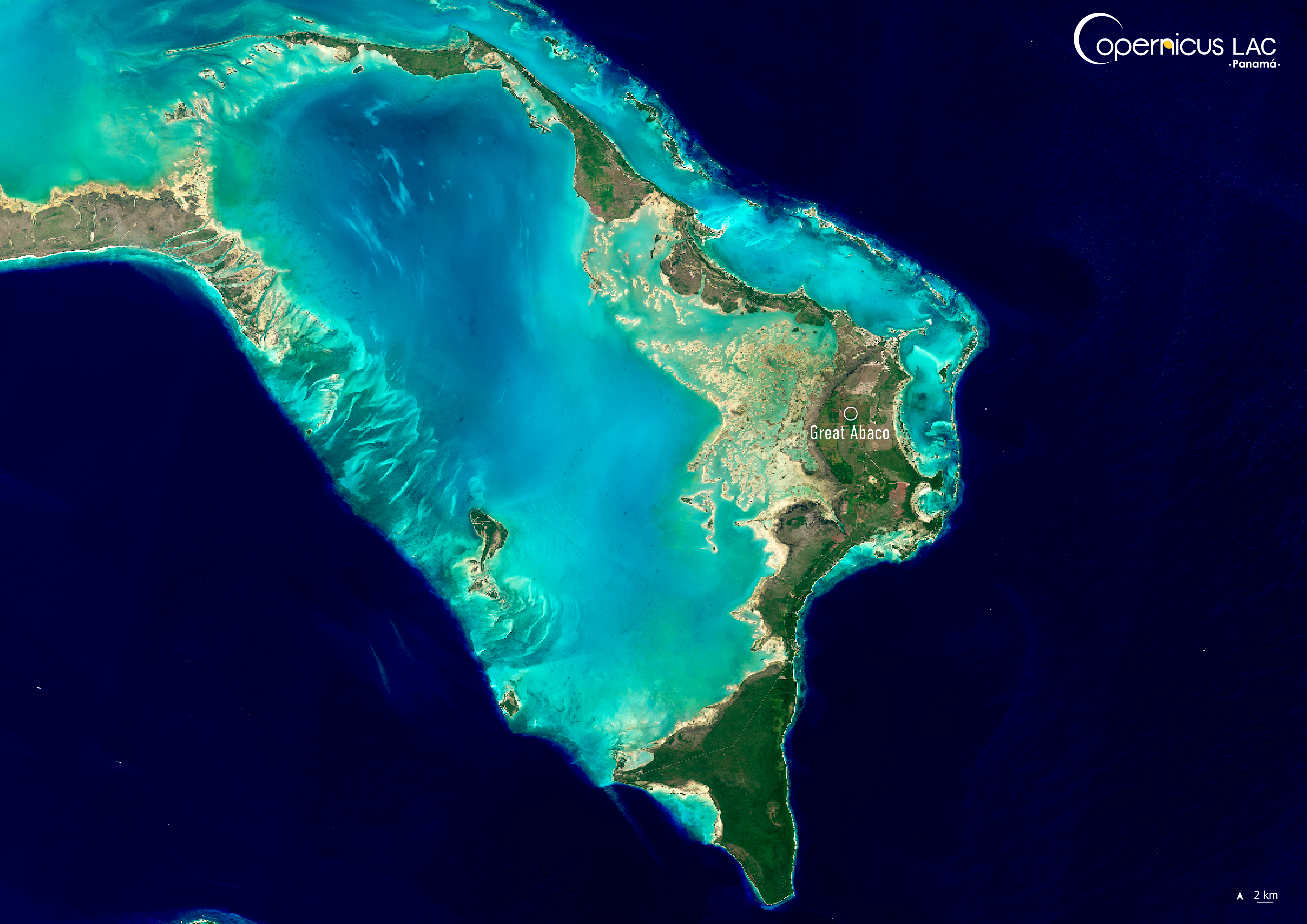
This Copernicus Sentinel-2 image shows Great Abaco Island, The Bahamas, as it appeared on March 7, 2025.
The Bahamas consist of more than 700 islands including the largest tropical shallow water area in the Western Atlantic. The archipelago lies within what meteorologists call “Hurricane Alley”, a section of warm water in the Atlantic Ocean spanning from the west coast of Northern Africa to the Gulf of Mexico, where conditions favour the formation of tropical cyclones. Climate change is increasing the threat of these storms, since rising ocean temperatures accelerate hurricane development and intensity.
For instance, in 2019, Hurricane Dorian made landfall in The Bahamas as a Category 5 storm with sustained winds of 295 km/h, one of the strongest hurricanes ever recorded in the Atlantic. It caused damages exceeding $3.4 billion USD and displaced around 14,000 people. Regional agencies estimate that more than 80% of the structures on Great Abaco and Grand Bahama were damaged or destroyed.
Copernicus data helps to monitor these events and assess damage in near-real time.
A recent example is the data and products delivered to support local authorities in responding to Hurricane Beryl (2024). For instance, Copernicus Marine delivered free and open data on a wide range of ocean variables, including sea surface temperature, wave height, and wind speed, which supported the tracking and monitoring of the Hurricane. In addition, in the immediate aftermath of Beryl’s passage, the Copernicus Emergency Management Service was activated multiple times to provide damage assessments. The full range of activities, including how the CopernicusLAC Panama Centre aims to increase resilience to hurricanes and other climate change-induced weather events, is described in this article.
To stay updated on the latest activities from our Centre, be sure to follow us on LinkedIn, Instagram, X, and subscribe to our newsletter.
Background Information
The Copernicus LAC Panama Centre’s activities take place within the overall context of the EU-LAC Digital Alliance, which is a strategic framework for promoting cooperation between the EU and the LAC region on digital and space issues under the EU Global Gateway umbrella. Within this context, the European Space Agency (ESA) is coordinating the Centre’s implementation on the basis of a Contribution Agreement with the Directorate-General for International Partnerships (DG INTPA) of the European Commission, and in close collaboration with Panama’s government, MIRE (Ministry of Foreign Affairs), Government Innovation Authority (AIG), and SENACYT (National Secretariat for Science, Technology and Innovation).
The CopernicusLAC Panama Centre will serve as a hub for innovation in the Latin America and Caribbean region, supporting national and local entities in leveraging Copernicus data and information to boost socio-economic benefits and resilience. In addition to providing engagement opportunities, the Centre is developing geospatial Disaster Risk Reduction (DRR) Earth Observation (EO) Services (addressing hydrometeorological hazards, wildfires, geological hazards, and hazard exposure) in close collaboration with local users and stakeholders, to whom they will be handed over to ensure that the unique needs of the region are addressed in the long term.
In addition, knowledge and skills transfer is a key element of the CopernicusLAC Panama Centre, which hosts a Digital Campus with access to training modules and educational resources for technical users and citizens alike. The Centre will also organise community-building events, policy dialogues and industry matchmaking, as well as hackathons and other EO data challenges to stimulate user adoption of Copernicus data and innovation. These events will also foster cross-collaboration among EO, disaster risk reduction (DRR) and other relevant ecosystems.
Finally, the Centre will support the development of a high-power computing and data storage cloud infrastructure for the LAC region. One of the final objectives of the Centre is to promote the development of communities of practice and to strengthen the knowledge and use of tools for DRR and other application areas in the public sector, academia, the private sector, and social organisations.