


Date: 27 January 2025
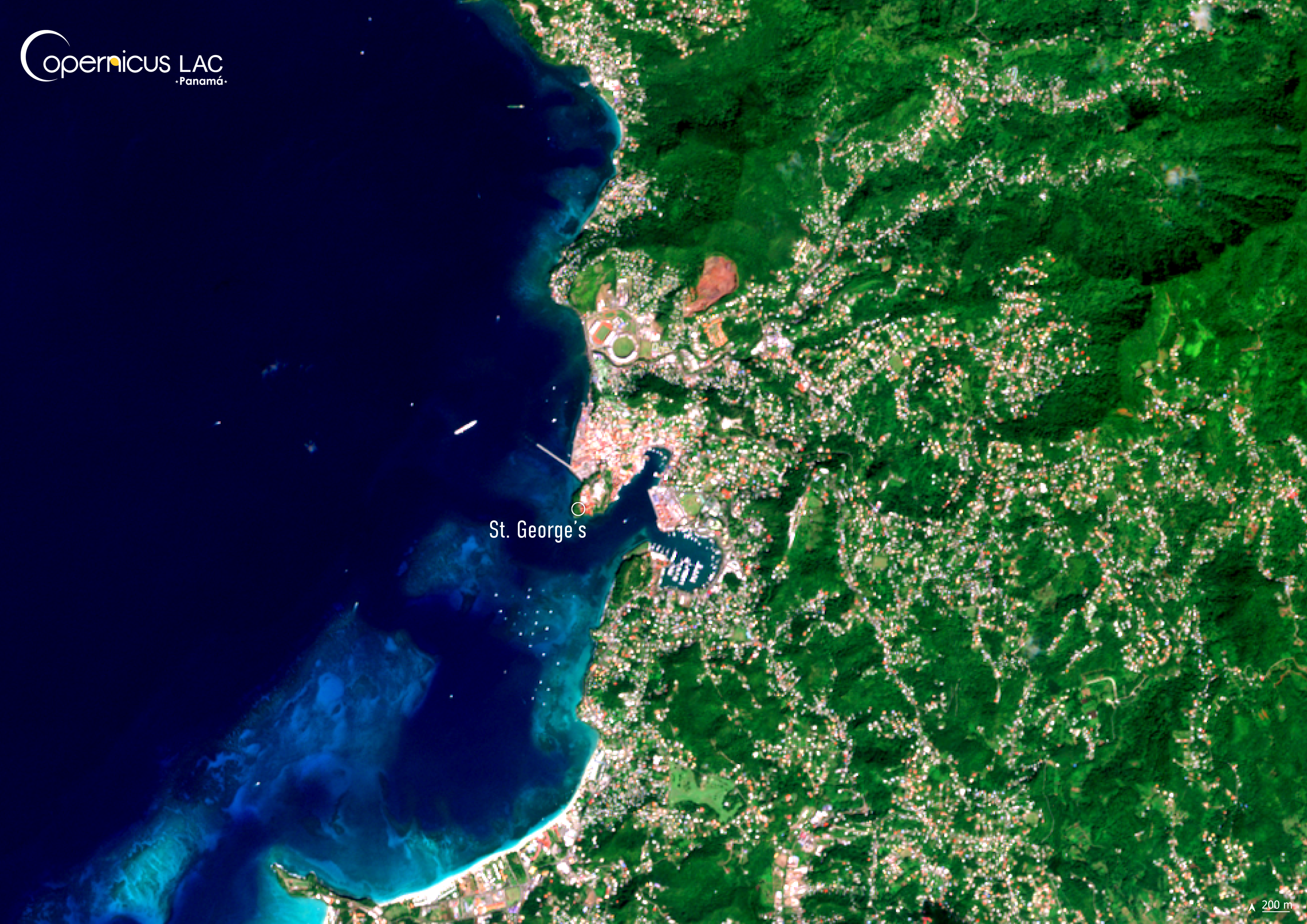
Location: St. George’s, Grenada
Credit: Copernicus Sentinel-2 image, processed by the CopernicusLAC Panama Centre
Description:
This Copernicus Sentinel-2 image shows St. George’s, capital of Grenada, as it appeared on 27 January 2025.
Grenada is highly exposed to several types of natural disasters, with hurricanes representing the most significant threat. Over the past 30 years, their frequency and intensity have increased, often resulting in widespread destruction and severe impacts on the economy.
Because of the island’s mountainous interior, most of the population and livelihoods are concentrated along the coast. That is the case of the capital, St. George’s, which is built around a horseshoe-shaped harbour, with a high concentration of people and assets, leaving it particularly vulnerable to the impacts of severe storms.
Between 1999 and 2025, Grenadians have faced the consecuences of four hurricanes (Lenny in 1999, Ivan in 2004, Emily in 2005, and Beryl in 2024). The most recent, Hurricane Beryl, struck the country on 1 July 2024, causing an estimate of $218 million in damages.
Discover how, during the Hurricane Beryl crisis, Copernicus supported Caribbean authorities with timely data and products, and how the CopernicusLAC Panama Centre is helping strengthen resilience against hurricanes and other climate-driven extreme events in our blog article.
To stay updated on the latest activities from our Centre, be sure to follow us on LinkedIn, Instagram and X.
Background Information
The Copernicus LAC Panama Centre’s activities take place within the overall context of the EU-LAC Digital Alliance, which is a strategic framework for promoting cooperation between the EU and the LAC region on digital and space issues under the EU Global Gateway umbrella. Within this context, the European Space Agency (ESA) is coordinating the Centre’s implementation on the basis of a Contribution Agreement with the Directorate-General for International Partnerships (DG INTPA) of the European Commission, and in close collaboration with Panama’s government, MIRE (Ministry of Foreign Affairs), Government Innovation Authority (AIG), and SENACYT (National Secretariat for Science, Technology and Innovation).
The CopernicusLAC Panama Centre will serve as a hub for innovation in the Latin America and Caribbean region, supporting national and local entities in leveraging Copernicus data and information to boost socio-economic benefits and resilience. In addition to providing engagement opportunities, the Centre is developing geospatial Disaster Risk Reduction (DRR) Earth Observation (EO) Services (addressing hydrometeorological hazards, wildfires, geological hazards, and hazard exposure) in close collaboration with local users and stakeholders, to whom they will be handed over to ensure that the unique needs of the region are addressed in the long term.
In addition, knowledge and skills transfer is a key element of the CopernicusLAC Panama Centre, which hosts a Digital Campus with access to training modules and educational resources for technical users and citizens alike. The Centre will also organise community-building events, policy dialogues and industry matchmaking, as well as hackathons and other EO data challenges to stimulate user adoption of Copernicus data and innovation. These events will also foster cross-collaboration among EO, disaster risk reduction (DRR) and other relevant ecosystems.
Finally, the Centre will support the development of a high-power computing and data storage cloud infrastructure for the LAC region. One of the final objectives of the Centre is to promote the development of communities of practice and to strengthen the knowledge and use of tools for DRR and other application areas in the public sector, academia, the private sector, and social organisations.