


On 22 September 2025, the city of Antigua, Guatemala, was the scene of an important milestone for bi-regional cooperation between the European Union (EU) and Latin America and the Caribbean (LAC): the Copernicus Policy Dialogue on Earth Observation for Disaster Risk Reduction.
Organised by the CopernicusLAC Centre in Panama, this high-level event was held within the framework of the EU-LAC Digital Alliance Week, with the aim of strengthening the role of satellite data as a strategic tool for addressing the growing challenges posed by disasters in the region.
The dialogue was inaugurated by the Vice-President of Guatemala, H.E. Karin Herrera, and brought together delegations from 14 countries, along with representatives from 6 regional organisations and several international organisations, including United Nations agencies and development banks.
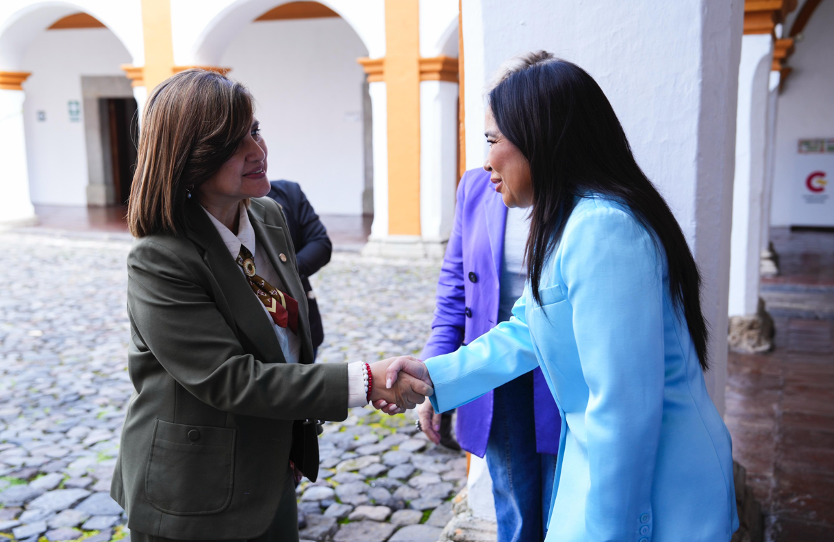 The Vice-President of Guatemala, Her Excellency Karin Herrera welcomed by Claudia Herrera, Stakeholder Liaison Officer of the CopernicusLAC Panama Centre.
During the event, it was emphasised that disasters should not be seen as purely natural events, but as the outcome of natural hazards interacting with social, economic, and structural vulnerabilities. In this regard, Earth Observation, particularly through the European Union’s Copernicus programme, was recognised as a key resource not only for emergency response, but also for prevention, preparedness, recovery and, above all, sustainable and resilient development.
Key Takeaways from the Dialogue
Throughout the day, the discussions reflected a deep understanding of the regional context. It was highlighted that Latin America and the Caribbean is one of the most exposed regions of the world to systemic risk chains, in which hydrometeorological, geophysical, environmental and socio-economic threats are intertwined. In this environment, Earth Observation and open data ecosystems such as Copernicus are key tools for near real-time monitoring, mapping of threats and exposures, and assessing their impacts. This information enables more accurate and informed decision-making.
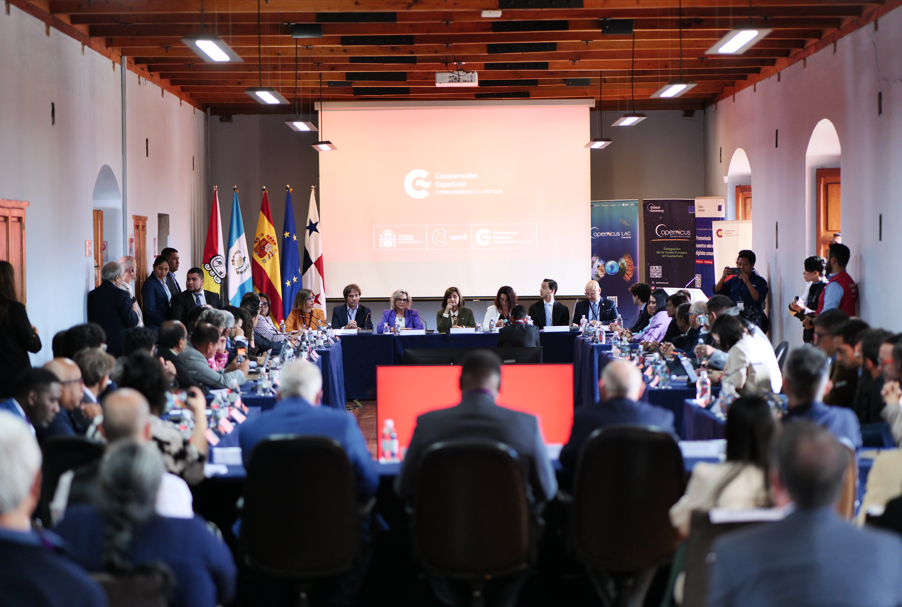 Delegations from 14 countries and representatives from regional and international organisations participated in the event, as well as stakeholders from governments, the private sector, academia, civil society and technical organisations from Europe, Latin America and the Caribbean.
It was also recognised that the benefits of this data extend beyond technical applications, delivering tangible societal and territorial value: supporting disaster risk reduction, protecting lives and livelihoods, preserving critical infrastructure, safeguarding ecosystems, and informing public and private investment in more resilient development models. To achieve this, it is essential that countries strengthen their national capacities and promote cooperation between institutions, ensuring their priorities are adequately addressed through the effective use of Earth Observation data and services.
A cross-cutting theme was the need to integrate disaster risk management with climate action, territorial planning, environmental and forest protection, as well as inclusive social policies, with a special focus on gender, youth and indigenous peoples. This integration must be aligned with global frameworks such as the Sendai Framework for Disaster Risk Reduction and the 2030 Agenda.
It was also emphasised that support from international institutions, such as United Nations agencies and development banks, must be aligned with national and regional priorities, promoting more effective and contextualised cooperation. In this regard, collaboration between the EU and LAC was recognised as instrumental in expanding the operational use of Earth Observation in the region, particularly within an open data framework which ensures interoperability and promotes the ethical use of information.
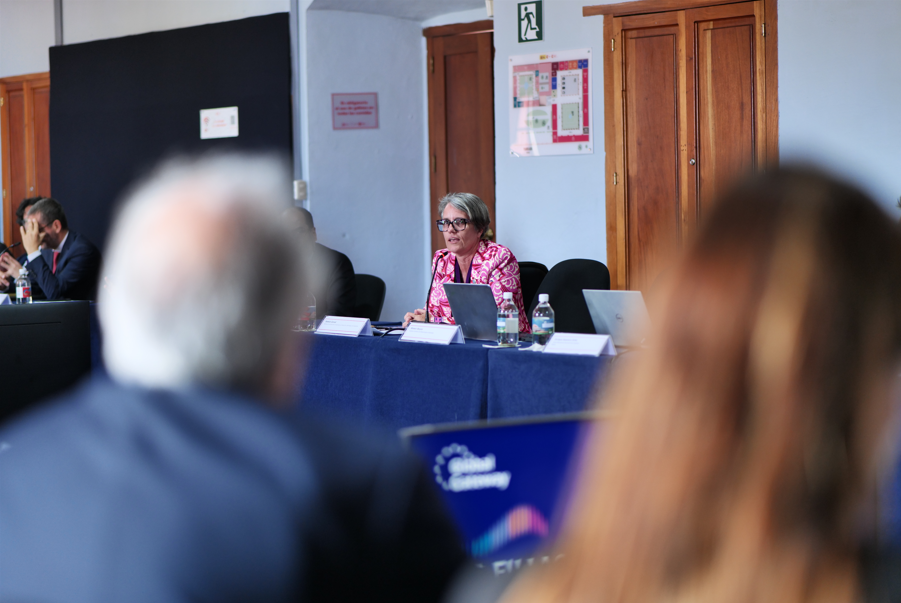
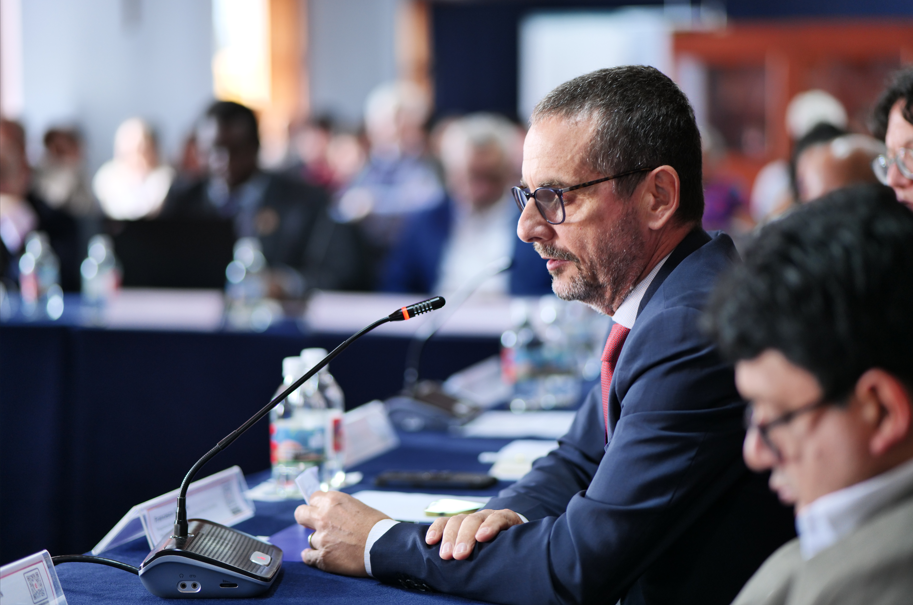
During the day, statements were heard from all the entities participating in the Policy Dialogue. In these images: Ms Saskia Carusi (UNDRR) and Mr Francesco Gaetani (UNEP)
Another key point was the need to institutionalise Earth observation services at national and subnational level. This involves establishing governance mechanisms which promote inter-institutional and cross-border coordination and ensuring that satellite products are integrated into operational protocols, multisectoral platforms and emergency operations centres.
The importance of developing, adapting and scaling up specific services which respond to the concrete needs of the region was emphasised. These include services related to monitoring floods (extent, frequency, and depth), droughts, wildfires (including assessment of burned areas and their recovery), ground movements, geological phenomena and agricultural monitoring. Their ownership by the competent entities in the countries has also been pointed out as an essential aspect for their sustainability and effectiveness.
In terms of capacity building, a comprehensive strategy was proposed including basic to advanced technical training, simulation exercises, hackathons, communities of practice, and technical assistance missions. These actions should encourage the participation of universities, research centres, small local technology companies, and civil society organisations, expanding the base of trained actors in the region.
Regional cooperation was also identified as a strategic priority, especially for advancing shared data platforms, joint risk assessments, and interoperable early warning systems. To this end, it was proposed to intensify collaboration with organisations such as the Association of Caribbean States (ACS), the Coordination Centre for the Prevention of Disasters in Central America and the Dominican Republic (CEPREDENAC), the Caribbean Disaster Emergency Management Agency (CDEMA), the Caribbean Institute of Meteorology and Hydrology (CIMH), and the Andean Community – Andean Committee for Disaster Prevention and Response (CAN-CAPRADE), among others.
In addition, the importance of ensuring that Earth Observation-based services and solutions are applicable, scalable and effectively implementable in local contexts was highlighted. To facilitate their adoption, key activities such as the development of phased training programmes, roadmaps for technology transfer, and the incorporation of these services into everyday institutional operations should be promoted. It is needed to establish open standards, control data quality, ensure interoperability between platforms, and promote their integration at different levels of government.
Another crucial element is financing and sustainability. The identification of financial mechanisms, economic partnerships, and collaboration schemes with the private sector was proposed to ensure the continuity and expansion of the services provided by Copernicus. Added to this is the incorporation of inclusive approaches as well as the social and environmental safeguards, the promotion of community participation, the use of accessible visualisations, and attention to cybersecurity aspects to protect critical systems and data.
Finally, participants proposed appointing a national focal point in each country to facilitate the coordination of future cooperation actions within the EU-LAC framework as well as their follow-up. This would enable continuity of initiatives, improve communication between regional and European actors, and increase the impact of public policies on risk management.
The role of the CopernicusLAC Panama Centre
This successful initiative reaffirms the CopernicusLAC Panama Centre’s commitment to promoting cooperation between the EU and LAC stakeholders in the use of Earth observation technologies. By working in close coordination with regional and international partners and within the EU-LAC Digital Alliance, and the EU Global Gateway strategy frameworks, the Centre not only enables the exchange of knowledge and technical capabilities but also drives the development of concrete, sustainable solutions tailored to the needs of each territory.
The outcomes of this dialogue provide an ambitious yet realistic roadmap for strengthening disaster resilience in Latin American and the Caribbean countries, enabling them to fully harness satellite data potential for their digital transformation and sustainable development.