


Panama City, 3 March 2025. Last Friday, the CopernicusLAC Panama Centre concluded its second online training, focused on Remote Sensing for Disaster Risk Reduction and Forest Fire Preparedness.
Over the course of five days, more than 270 people from over 15 countries in Latin America and the Caribbean (LAC) participated in the different sessions which made up the two training modules of the course, led by experts from Indra.
The first module, focused on remote sensing for disaster risk reduction, provided participants with theoretical knowledge and practical exercises on the basics of remote sensing and disaster risk reduction (DRR), advanced techniques for disaster monitoring with remote sensing, and information on future trends in DRR and remote sensing.
The second module, which took place on the last two days of the training, focused on remote sensing for forest fire preparedness. It covered basics and applications of remote sensing for forest fires as well as practical exercises for detecting changes in forest fires with remote sensing.
Javier Arregui, First Counsellor for Cooperation in Digital and Space Areas of the Delegation of the European Union to Panama, highlighted in the opening remarks for the course the crucial role of the CopernicusLAC Panama Centre in capacity building in the region. He further stressed the commitment of European institutions in building greater resilience in LAC countries through initiatives such as the Global Gateway.
Claudia Herrera, Stakeholder Liaison Officer of the CopernicusLAC Panama Centre, invited participants to “make the most of the course, to interact, share experiences and generate connections which will further increase the use of Copernicus data for the benefit of the most exposed and vulnerable populations”. She also encouraged the participants to generate synergies for advancing the use of technology for risk reduction in the region.
With the completion of this online training, all course contents and materials will be made available to the general public for download via the Moodle platform of the Centre’s Digital Campus. To access the materials, it is necessary to register as a user.
Over the next three years, the Centre will organise in-person and online training sessions covering key topics such as flood detection, ground motion monitoring, and disaster risk reduction. Information on the courses, as well as free tools and training materials, are available on the Digital Campus of the CopernicusLAC Panama website.
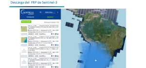
Demonstration of the Copernicus Sentinel-3 Fire Radiative Power
Background Information
The Copernicus LAC Panama Centre’s activities take place within the overall context of the EU-LAC Digital Alliance, which is a strategic framework for promoting cooperation between the EU and the LAC region on digital and space issues under the EU Global Gateway umbrella. Within this context, the European Space Agency (ESA) is coordinating the Centre’s implementation on the basis of a Contribution Agreement with the Directorate-General for International Partnerships (DG INTPA) of the European Commission, and in close collaboration with Panama’s government including, MIRE (Ministry of Foreign Affairs), Government Innovation Authority (AIG), and SENACYT (National Secretariat for Science, Technology and Innovation).