





Floods are one of the most impacting disasters for the agricultural sector. Accurately determining the extent of the affected areas, exposed crops, potential lost production, and economic impact is fundamental to understanding the real consequences of these events.
To this end, Earth Observation using satellite data is of great help as it provides objective and up-to-date information for decision-making. These technologies allow to identify flooded areas, quantify damage, and efficiently plan response and recovery measures.
Within this framework, the CopernicusLAC Panama Regional Centre has developed a specific pilot service to analyse the impact of floods on agriculture.
Discover the Flood Impact on Agriculture service
The Flood Impact on Agriculture service combines information from the Copernicus satellites with agricultural and economic data to assess the consequences of a flood on agricultural production.
The service is based on the use of radar technology, which allows images of the flood to be obtained even in the presence of clouds, enabling the extent of flooded areas to be identified immediately after an event. Subsequently, this is complemented with data on crop types, agricultural production, crop calendars, and economic value to build a more comprehensive view of the real impact of the flood.
For this purpose, other services from the Centre are integrated into this use case:
- Flood Extent Mapping (FEM): Identifies areas covered by water during an event using Copernicus Sentinel-1 imagery.
- Economic Value Mapping (EVM): Generates agricultural economic value layers by integrating geospatial information data with agricultural databases.Flood Impact on Agriculture: combines the results of the above services to transform geographical information into useful indicators for disaster management. The process is designed to run on demand based on two inputs: an area of interest and the date of the flood event. Furthermore, when local information is available, the service can incorporate more detailed data on crop yields, phenological calendars, or the vulnerability of specific crops. This allows to refine estimates and provide a more realistic assessment of potential production losses associated with a flood event.
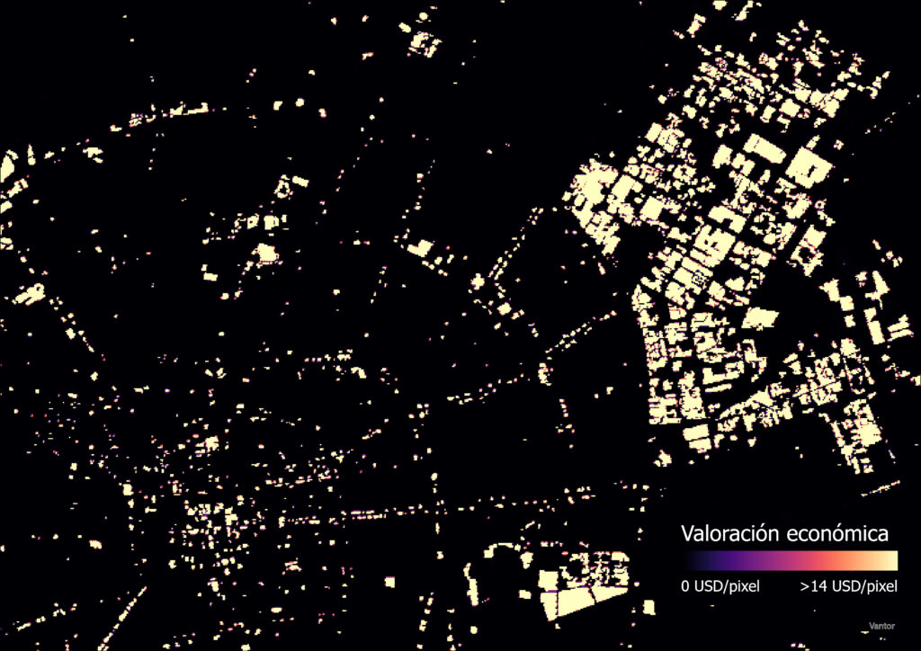
Thanks to the integration of these services, products of great interest to public administration and agricultural organisations are generated, including:
- Maps of affected agricultural land.
- Maps showing the number of hectares of cultivated land flooded.
- Estimates of potential production losses.
- Assessments of the economic impact associated with the event.
Service demonstration in Bolivia
This pilot service is being developed and validated with a use case in Bolivia, in collaboration with local users from the agricultural sector. Throughout the various stages of development, users are actively involved in data validation, algorithm testing, and the definition of operational requirements, ensuring that the results meet the actual needs of agricultural management.
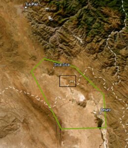
A particularly telling example can be seen in the agricultural areas between La Paz and Oruro, where flooding is a recurring phenomenon which periodically affects agricultural activity. The combination of flat terrain and the influence of the regional hydrological configuration contributes to the accumulation of standing water during periods of heavy rainfall. As a result, crops can suffer damage that leads to significant economic losses for the local economy.
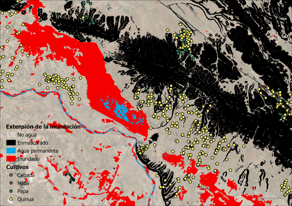
Once these services have been activated, maps showing the extent of the flooding can be overlaid with the distribution of the various crops in the area. This makes it possible to identify which agricultural plots have been affected and which crops are most at risk of flooding. In addition, economic assessment layers are also integrated, enabling the estimation of economic impact and potential production losses.
Undoubtedly, this use case demonstrates how Earth Observation and Copernicus enable a comprehensive assessment of the consequences of a flood on agricultural activity, providing key information to support the planning of recovery efforts, the prioritisation of aid and the design of adaptation measures that help to improve the agricultural sector’s resilience to future natural disasters.
Sign up for the newsletter when you register on the digital campus and follow us on social media to keep up to date with the Centre’s activities.
Background information
The activities of the CopernicusLAC Panama Regional Centre are part of the EU-LAC Digital Alliance, which is a strategic framework to promote cooperation between the European Union (EU) and the Latin America and Caribbean (LAC) region on digital and space issues under the umbrella of the EU Global Gateway strategy. In this context, the European Space Agency coordinates the implementation of the Centre on the basis of a Contribution Agreement with the Directorate General for International Partnerships (DG INTPA) of the European Commission, and in close collaboration with the Government of Panama, the Ministry of Foreign Affairs (MIRE), the Government Innovation Agency (AIG), and the SENACYT (National Secretariat for Science, Technology and Innovation).