


- More than 30 participants from 8 different countries are taking part in a five-day training course in Panama City to strengthen their capabilities and help improve the resilience of the Latin American and Caribbean region to disaster risk.
The CopernicusLAC Panama Centre, on behalf of the European Space Agency (ESA) and in close collaboration with the Delegation of the European Union in Panama and the National Authority for Government Innovation (AIG), has begun a regional training on remote sensing applied to flood risk. The course is taking place from 21 to 25 September 2026 at the AIG’s premises.
More than 30 participants from Panamanian organisations and representatives from countries including Chile, Peru, Guatemala, Brazil, Argentina, Cuba and Honduras will receive five days’ training in the use of satellite data – specifically that provided by the Copernicus programme – to support the assessment and management of flood risk. Participants will explore how optical and SAR (synthetic aperture radar) imagery can be used to identify areas prone to flooding, map affected areas in real time during an event, and carry out an impact analysis. The course’s practical approach will enable participants to gain hands-on experience in processing and analysing satellite data using specific software and applications such as QGIS and SNAP.
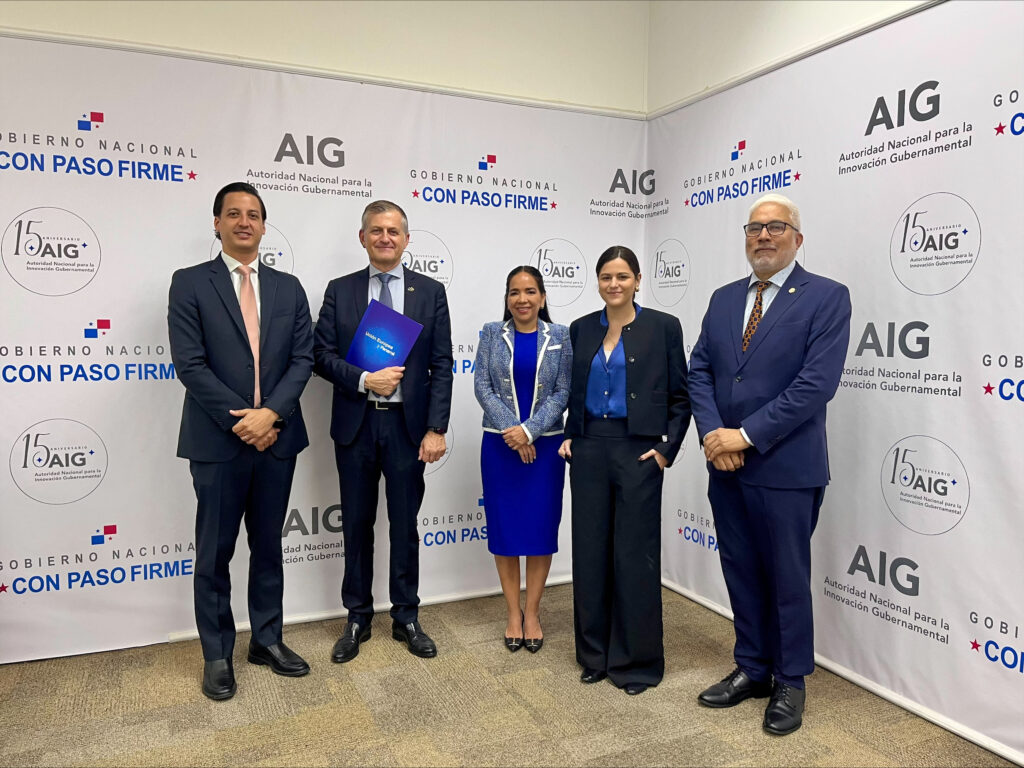
Speaking on behalf of the AIG, its Deputy Director, Engineer Francisco Guinard, emphasised that “thanks to the efforts of the AIG, the roll-out of the infrastructure for the CopernicusLAC Panama Centre’s data centre is reaching key milestones. Soon, the facilities in Panama will be ready to host the Centre’s services, which will enable us to lead the way in knowledge transfer and open our doors to institutional visits. Building on this solid foundation, we consider it essential to accelerate the Centre’s international reach, particularly towards our partners in Latin America and the Caribbean.”
The welcome ceremony was also attended by the European Union Ambassador to Panama, H.E. Andrea Matteo Fontana, stated that “the main objective of the Digital Alliance, within the framework of the Global Gateway strategy, is to drive a people-centred digital transition. However, the current challenge goes beyond accessibility, as it is essential to ensure that citizens, businesses and public administrations have the necessary tools to extract and make the most of the value of this information.”
Dr Claudia Herrera, Stakeholder Liaison Officer at the CopernicusLAC Panama Centre, stated at the welcome ceremony: “Copernicus is making open, free and accessible data available, but the greatest added value is that it is building capacity, knowledge and skills so that satellite data can be translated into concrete actions, decision-making, prevention, minimising the impact of disasters, saving lives and, above all, driving a more robust development process in our countries, with disaster risk management integrated across all sectors.”
The course is being delivered by Drs Carmelo Alonso and Alfredo Romo, technical experts in Earth observation at the Spanish company Indra.
About CopernicusLAC Panama and its knowledge transfer activities
The Centre’s activities form part of the broader context of the EU-LAC Digital Alliance, a strategic framework for promoting cooperation between the European Union (EU) and the Latin America and Caribbean (LAC) region on digital and space-related issues under the Global Gateway strategy. In this context, the European Space Agency (ESA) coordinates the Centre’s operations on the basis of a Contribution Agreement with the European Commission’s Directorate-General for International Partnerships (DG INTPA), and in close collaboration with the Government of Panama, the National Authority for Government Innovation (AIG), the Ministry of Foreign Affairs (MIRE) and the National Secretariat for Science, Technology and Innovation (SENACYT).
The CopernicusLAC Panama Centre serves as a platform for innovation in the Latin American and Caribbean region, supporting regional, national and local organisations in utilising Copernicus open data to enhance socio-economic benefits and resilience. The Centre is developing bespoke Earth observation services that address hydrometeorological or geological risks, as well as risk exposure services, amongst others. These developments are being carried out in close collaboration with users and stakeholders from the participating countries to ensure that real needs are addressed.
Furthermore, the transfer of knowledge and skills is an essential element of the Centre, which hosts a Digital Campus offering access to training modules and educational resources for technical users and members of the public interested in Earth observation. The Centre also organises events to foster communities, policy dialogues and matchmaking with the private sector, as well as hackathons and other challenges related to Earth observation (EO) data to encourage the adoption of Copernicus data by users in the region. Furthermore, these events will foster cross-sector collaboration between the EO, disaster risk reduction (DRR) and other related ecosystems.
Finally, the Centre will include the development of high-performance computing and cloud computing infrastructure for the LAC region.