Within this use case three services designed for comprehensive monitoring of forest fires – covering all stages of the disaster risk reduction cycle: before, during and after the event – will be applied. For this purpose, Copernicus Sentinel-2 imagery and Copernicus Sentinel-3 thermal measurements will be used.
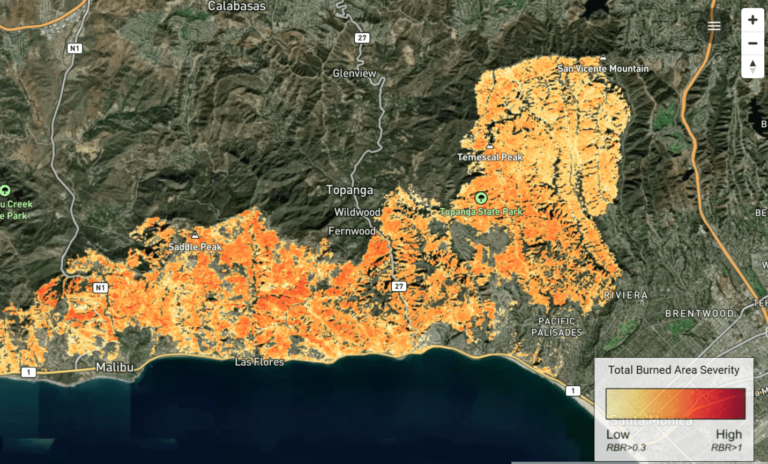
One service will support wildfire preparedness operations by providing on-demand maps of the fire danger index over the user-selected region of interest. For mapping ongoing events, a second service will detect wildfires via hotspot analysis and trigger the generation of fire extension, fire probability, and fire severity maps. Finally, the third service will provide information on post-fire spectral recovery in terms of monthly Normalised Difference Vegetation Index (NDVI) maps and time series per pixel of percentage of recovery.
Areas of application: Colombia and Central America
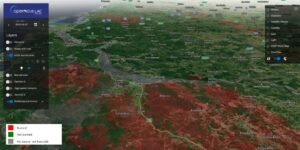
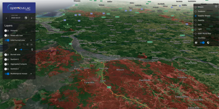
3D view in the CopernicusLAC platform of the burned area mapped of the Chilean wildfires (2023). Legend: Qualitative classes of burned, not burned and not burnable. Credits: Terradue and CopernicusLAC initiative.