Use Case 7 demonstrates how AI‑based geospatial analysis can support landslide preparedness by producing susceptibility maps and, when ground‑motion data are available, refined hazard maps. The Landslide Susceptibility and Hazard Mapping service integrates Sentinel‑2 NDVI, local geological and lithological layers, and inventories of past landslides to train machine‑learning models that estimate where slope conditions are most likely to permit failures.
When InSAR deformation information is available, the service incorporates it to enhance the hazard estimation. It accepts ground‑motion inputs from both SNAPPING PSI and kinesIS interferometric stacking, enabling the integration of displacement rates and time series to identify areas where intrinsic predisposition aligns with active or progressive terrain deformation.
The use case is applied in selected areas of Peru prone to landslides, identified together with local users. The resulting susceptibility and hazard maps support disaster preparedness, emergency response, protection of critical infrastructure, and urban land‑use planning, providing institutions with a transparent, reproducible and high‑value tool for landslide risk management.
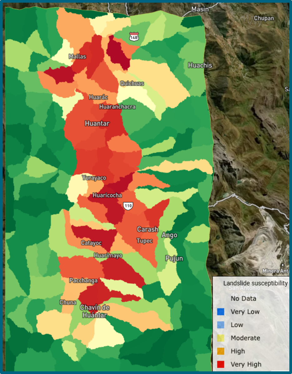
Landslide susceptibility map over Chavín de Huántar (Peru). Legend: qualitative classes of landslide susceptibility, from Very Low (blue colours) to Very High (red colours).