


For the Geological Hazard theme, the CopernicusLAC Platform offers a suite of Earth Observation services designed to support geological risk management through the monitoring and analysis of ground motion through SAR Interferometry. Machine Learning applied to multiple data sources is also exploited to extract the likelihood of landslide occurrence and its potential hazard, per pixel and per geotechnical unit.
Landslides Susceptibility and Hazard Mapping service
Landslide Susceptibility and Hazard Mapping provides on‑demand assessment of terrain predisposition to landslides using machine‑learning techniques applied to geospatial and environmental data. The service generates detailed landslide susceptibility maps and, where ground‑deformation information is available, landslide potential hazard maps, supporting preparedness, planning and risk‑reduction activities.
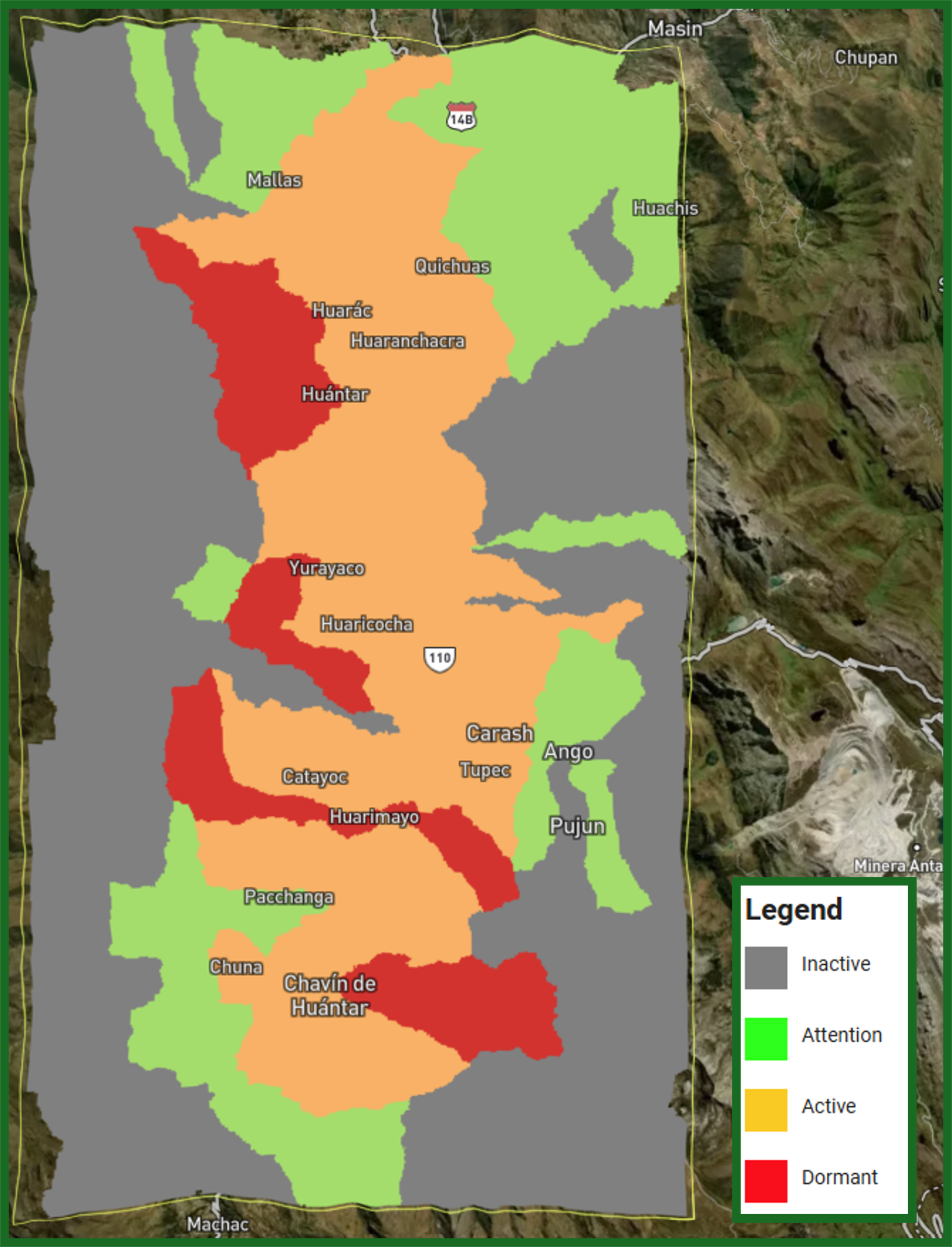
Landslide potential hazard map over Chavín de Huántar (Peru). Legend: qualitative classes of landslide potential hazard, encompassing the next activity levels: Inactive, Attention, Active and Dormant.
...
KinesIS
The kinesIS Interferometric Stacking service provides on‑demand mapping of terrain motion over large areas using Copernicus Sentinel‑1 SAR data. The service generates average ground‑motion rates in millimetres per year, derived from the combination of multiple interferometric observations, and supports the analysis of slow deformation processes related to geological and anthropogenic hazards.
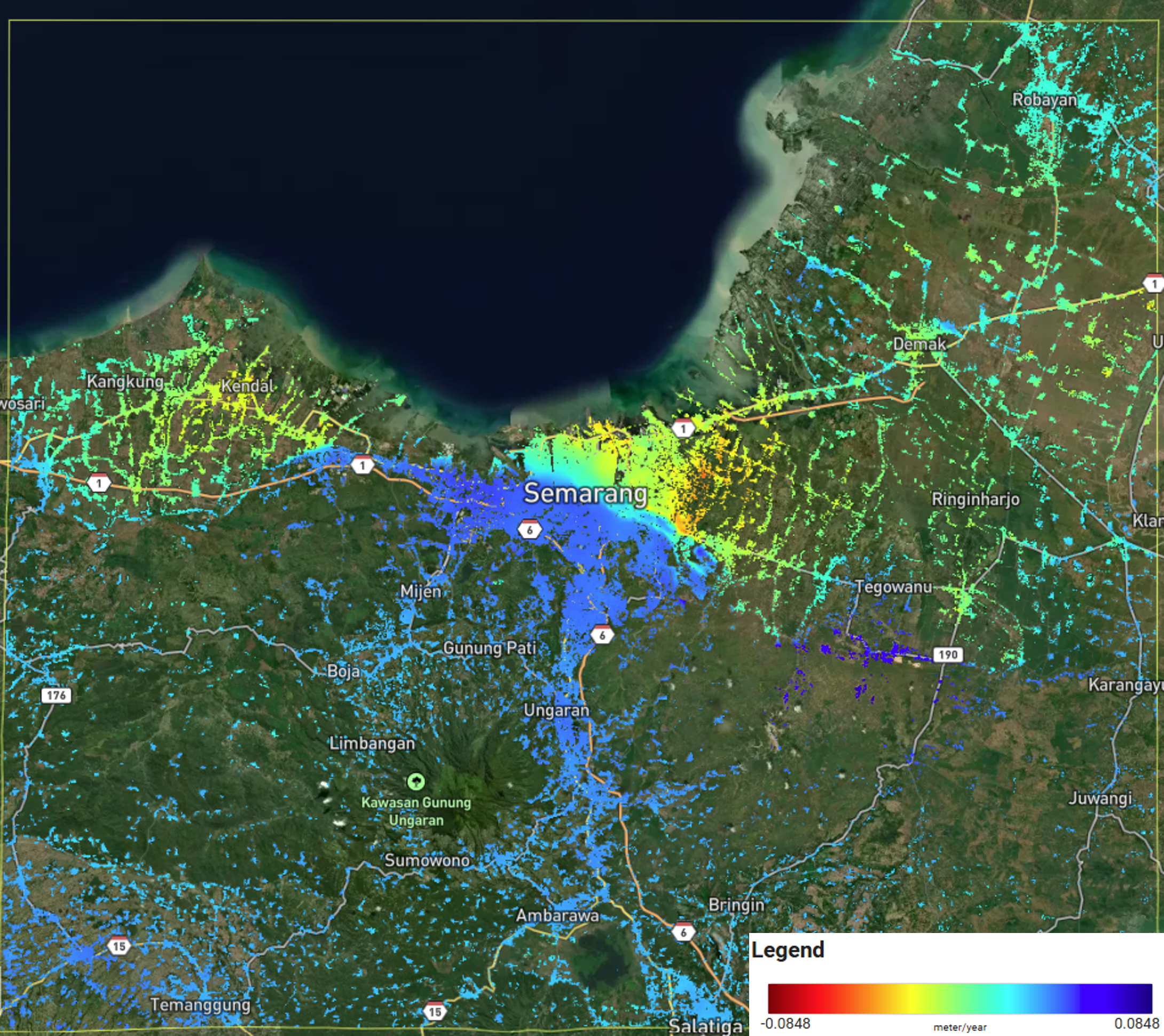
Example of kinesIS Line-of-Sight (LoS) ground motion rates over Semarang (Indonesia). Warmer colours indicate downward movement and cooler colours indicate uplift from the point of view of the satellite
...
3D Geometric Decomposition
The 3D Geometric Decomposition service supports the interpretation of InSAR‑derived ground‑motion measurements by transforming line‑of‑sight (LoS) deformation data into vertical and horizontal (east–west) motion components. By converting LoS velocities into physically meaningful directions, the service enables a clearer understanding of the underlying deformation mechanisms.
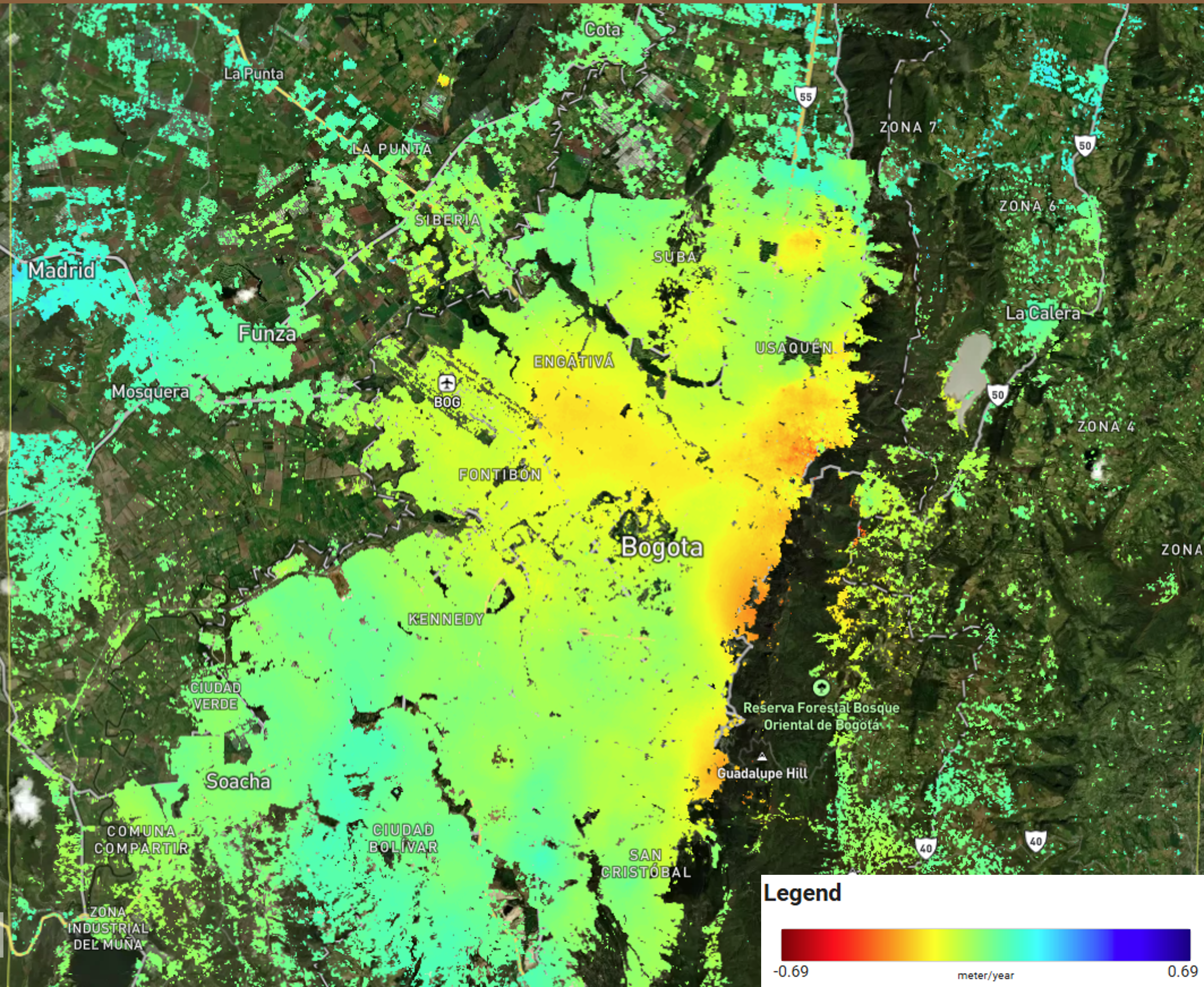
Example of vertical (up-down) ground motion rates over Bogotá (Colombia) in meters/year.
...