




Use Case 8 focuses on the detection and monitoring of terrain motion through satellite interferometry, addressing multiple geohazard contexts including subsidence, landslides, volcanic unrest, and fault‑related deformation. The approach supports regional risk assessment by identifying slow ground displacement patterns and providing early evidence of deformation that may precede hazardous events.
The use case relies primarily on the service kinesIS (interferometric stacking), which processes large archives of Sentinel‑1 data to generate consistent ground‑motion rates. These results are complemented by the service 3D geometric decomposition, which separates vertical and horizontal components of displacement to improve interpretability. Additionally, SNAPPING PSI is introduced for demonstration purposes, offering high‑resolution deformation mapping that can be compared against the kinesIS outputs.
A key objective of the use case is to enable geological experts to interpret the deformation signals detected by the InSAR‑based workflows, distinguishing movements attributable to different geohazards, such as slope instabilities, compaction‑driven subsidence or fault‑controlled deformation. While the processing workflows provide robust kinematic information, the geological attribution of the detected motion is performed by expert users participating in the case study.
The use case is applied in selected areas of Panama and Ecuador, chosen for their susceptibility to volcanic activity, subsidence processes and landslide dynamics. The resulting products are designed to support risk reduction, infrastructure monitoring, and territorial planning, offering institutions a flexible methodology that can be adapted to diverse data availability conditions and hazard contexts.
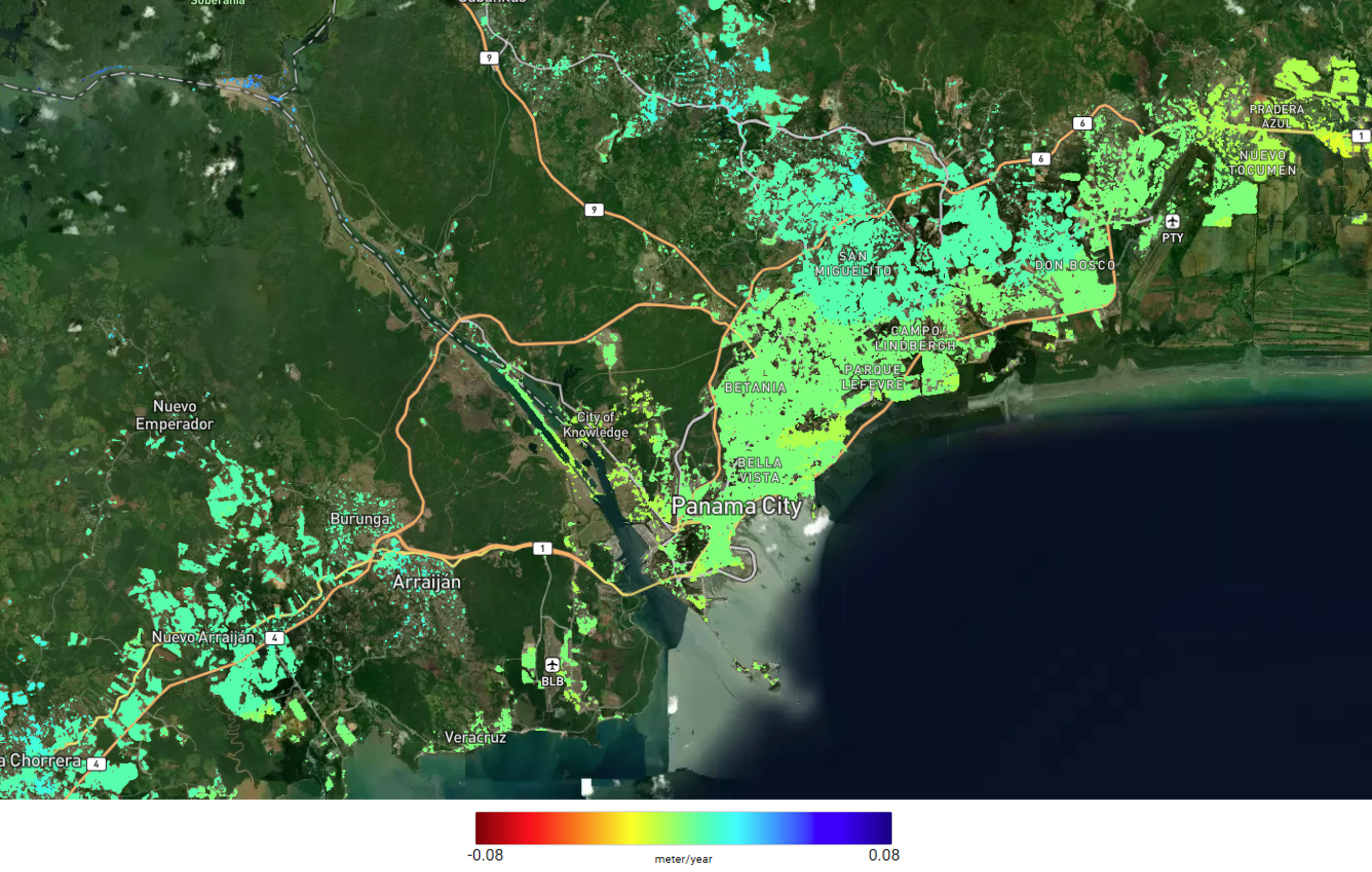
Ground motion rates in up-down component in Panama City in 2024.