Use Case 12 addresses the need for spatially explicit information on the economic value of territories to support disaster‑risk management and impact assessment. The use case demonstrates two complementary, on‑demand services that quantify the economic value of physical assets and ecosystem services within a user‑selected area of interest.
The Economic Value Mapping (EVM) service estimates the replacement value of exposed physical assets, including residential and industrial buildings, infrastructure (roads, railways), vehicles, agricultural stocks, industrial inventories and production systems. In parallel, the Ecosystem Services Valuation Mapping (ESVM) service applies established InVEST‑based approaches to monetise key ecosystem functions, such as carbon storage, nutrient retention and sediment retention. Both services rely on open geospatial layers combined with national statistics and economic data from trusted sources.
The workflows are executed on demand, allowing users to select the area of interest and tailor the analysis to their needs. Users can customise economic values by introducing their own aggregated asset values: at the national level in both services, and directly at the area‑of‑interest level in the case of the EVM service. This flexibility helps address limitations in official statistics and ensures adaptability across different national contexts.
The services have been applied in the Dominican Republic and demonstrated in other areas of Latin America and the Caribbean to showcase their broader potential. One example includes the use of the EVM service in Jamaica following Hurricane Melissa, where asset value layers were combined with flood extent information to support post‑event impact analysis.
The outputs consist of quantitative raster layers representing the spatial distribution of economic value for assets and ecosystem services. When overlaid with hazard and vulnerability data, these layers support disaster‑risk assessment, impact estimation, recovery planning and prioritisation of resources, providing institutions with a consistent and adaptable framework for economic exposure analysis.
Areas of application: Dominican Republic and other selected areas in Latin America and the Caribbean
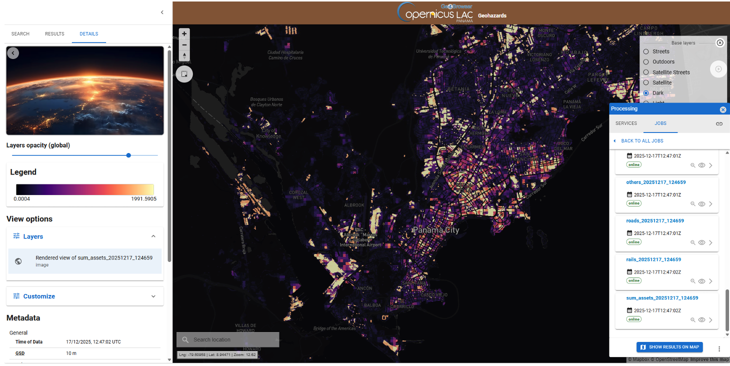
Example of an output from the Economic Value Mapping service on the CopernicusLAC platform, showing the cumulative value of all assets in each pixel in Panama City. Generated using the default economic values.