





As part of the activities of the CopernicusLAC Panama Centre, the development phase of the Population Distribution Mapping use case has been completed. Between March and October 2026, the algorithms were developed and tested, and a range of demonstrations were held for users.
Collaborations for capacity-building
This progress is the result of close collaboration between three partners with complementary roles:
- DLR, responsible for generating the geospatial products of the World Settlement Footprint (WSF) ecosystem and the population modelling algorithms.
- Terradue, in charge of integrating the services into the platform and deploying them.
- Indra, which coordinates all phases of the use case.
They are joined by numerous national, regional and international institutions from Peru, Brazil, Panama, Ecuador, Chile and Belize, which have taken an active part by providing requirements, validating results and guiding the evolution of the service so that it meets the region’s real needs:
- Panama: Ministry of Environment, Ministry of Housing and Land Management, Panama Canal Authority (ACP), Government Innovation Authority (AIG), Institute of Meteorology and Hydrology of Panama (IMHPA), National Land Administration Authority (ANATI) and Ministry of Economy and Finance (MEF).
- Chile: National Institute of Statistics (INE).
- Ecuador: National Secretariat for Risk Management (SNGR).
- Belize: National Emergency Management Organisation (NEMO).
- International: United Nations Environment Programme (UNEP).
- Regional: Water Centre for the Humid Tropics of Latin America and the Caribbean (CATHALAC) and the Andean Community.
High-resolution population data for disaster risk reduction
The main objective of this use case is to generate high-resolution population maps for Latin America and the Caribbean that provide detailed information on the population present in a given area and serve as a tool for disaster risk management.
By combining Earth Observation data with demographic data, the service produces maps at 10-metre resolution that make it possible to identify areas of high population density and unplanned urban growth, as well as to analyse how the territory evolves over time. Having this information in countries such as Peru, Ecuador, Brazil, Panama and Chile is essential for adopting appropriate prevention measures in the most exposed regions.
The service’s products
The service is built on three information layers:
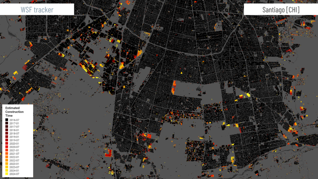
- Urban extent (WSF Tracker): using Sentinel-1 and Sentinel-2 imagery, identifies the spatial extent of urban settlements.
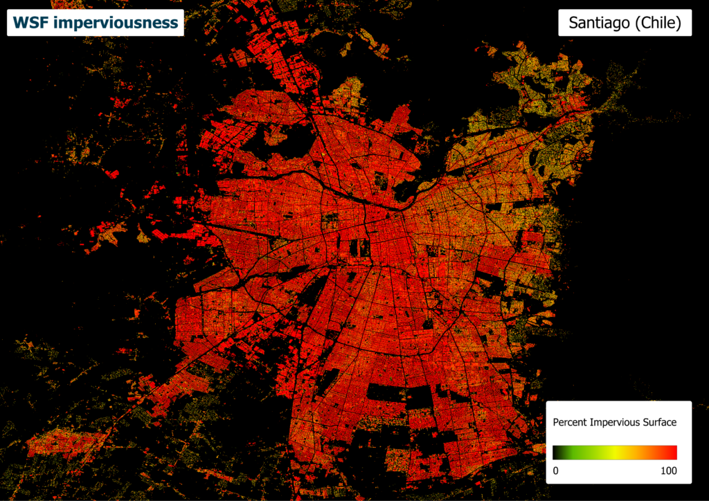
- Imperviousness (WSF Imperviousness): using Sentinel-2 imagery and auxiliary datasets, estimates the percentage of impervious surface in urban settlements.
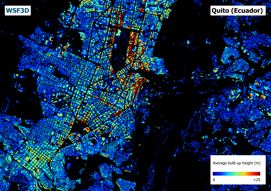
- Building height (WSF3D): provides the height of buildings, data that is indispensable for assessing structural exposure.
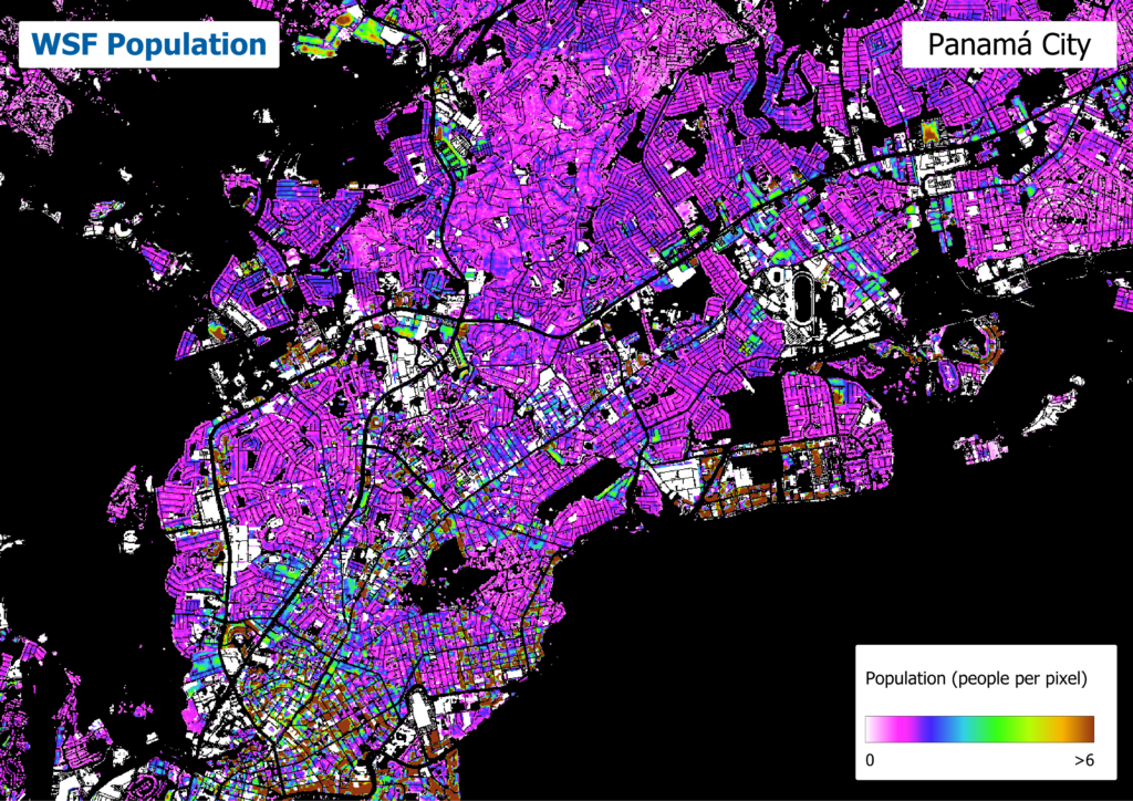
These layers are integrated into the final service, population distribution (WSF Population), which dynamically estimates population density per building or per pixel unit. The service is offered in two modes:
- Periodic: the system uses census data or UN estimates and automatically updates the results every six months.
- On demand: users provide their own population data and the area of interest, and the model is run with that information.
Next steps: training, demonstration and operational phase
With development complete, the next step will be capacity-building for collaborating and interested organisations, so that they receive the products and acquire the skills needed to integrate them into their operational workflows.
The demonstration phase will then begin, running from October 2026 to January 2027. During this phase, users will test the platform under realistic operational conditions and provide feedback that will help define the Service Level Agreements (SLAs).
Finally, from January 2027, the operational phase will begin, using the processing infrastructure of the CopernicusLAC Panama Centre in line with the agreed SLAs.
Background information
The activities of the CopernicusLAC Panama Regional Centre are developed in the framework of the EU-LAC Digital Alliance, which is a strategic framework to promote cooperation between the European Union (EU) and the Latin America and Caribbean (LAC) region on digital and space issues under the umbrella of the EU Global Gateway strategy. In this context, the European Space Agency coordinates the implementation of the Centre on the basis of a Contribution Agreement with the Directorate General for International Partnerships (DG INTPA) of the European Commission, and in close collaboration with the Government of Panama, the Ministry of Foreign Affairs (MIRE), the Government Innovation Agency (AIG), and the SENACYT (National Secretariat for Science, Technology and Innovation).