


Use Case 9 focuses on demonstrating the capabilities of the proprietary SNAPPING IFG and PSI service, which derive ground‑motion rates and displacement time series from Sentinel‑1 data. This advanced tool generates interferometric stacks and PSI‑based point measurements that enable consistent detection of deformation patterns across the selected areas of Mexico.
The service provides the spatial and temporal detail needed to analyse ground‑motion processes that are particularly relevant in urban environments, such as land subsidence driven by groundwater extraction, slope instabilities on urban fringes, and localised deformation associated with active faults.
A key part of the use case is user training in deformation‑signal interpretation. While SNAPPING PSI delivers the kinematic information (rates and displacement histories) the geological interpretation relies on expert users, who assess whether the observed signals correspond to subsidence, fault motion, or slope instability. This interpretative component is central to building local capacity for reliable geohazard assessment.
The resulting products support risk analysis, infrastructure management, and urban planning, offering a consistent and high-quality methodology for monitoring terrain deformation in the selected areas. As part of the use case, a perpetual license of the service is made available for the analysed sites, ensuring that institutions can continue using the workflow and its outputs operationally as part of their long‑term geohazard monitoring activities.
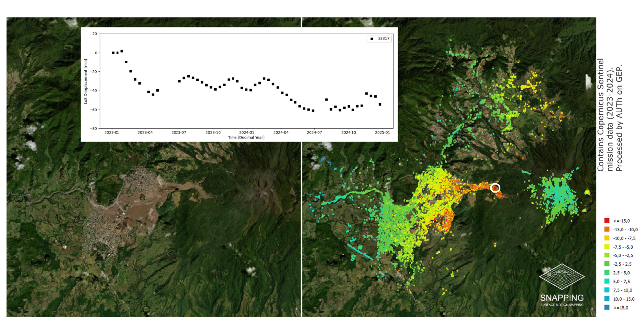
PSI-based point measurements of ground motion rates and time series over Paso Ancho, Panama. Obtained with SNAPPING PSI in GEP platform. Credits: Aristotle University of Thessaloniki