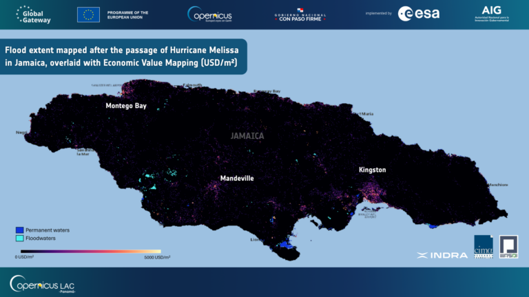
This use case demonstrates how satellite‑based hydrometeorological services can support flood preparedness through the systematic reconstruction and analysis of past flood events. Historical floods associated with hurricanes and extreme rainfall are rebuilt using the Flood Extent Mapping and Flood Depth Mapping services, producing consistent extent and depth maps for each event. Where national data is available, these products are complemented with the corresponding meteorological triggers, such as rainfall intensity, accumulated precipitation or wind speed, creating a country‑specific archive in which each flood map is linked, through its metadata, to the conditions that caused it.
Once this archive is established, users can retrieve past events that match the characteristics of an evolving or forecasted situation. By filtering on trigger thresholds (e.g., rainfall amounts or wind intensity), the system identifies analogous historical flood extents, enabling rapid comparison with current conditions as part of preparedness activities. In addition to the open‑source services, the use case also demonstrates the capabilities of the proprietary Urban Flood Mapping service.
Copernicus Sentinel-1 and Sentinel-2 imagery are used as inputs. The products include maps showing flood extent and flood depth for historical events.
Area of application: Jamaica, Guyana and Belize
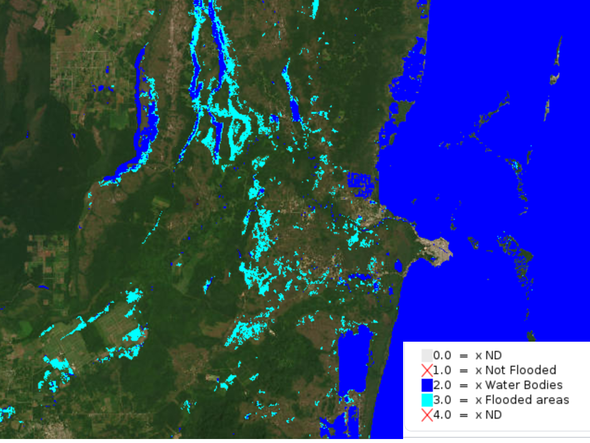
Example of flood extent map over Belize. Legend: permanent water, flood water.